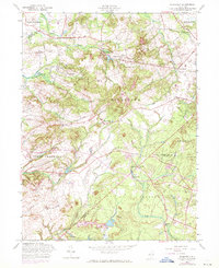
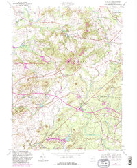
1957 Map of Roosevelt
USGS Topo · Published 1971About this map
Roosevelt and the surrounding townships of Millstone and Upper Freehold define this portion of central New Jersey, where the landscape transitions from rolling terrain to the headwaters of several major drainage systems. The map illustrates a complex network of small crossroads settlements including Clarksburg, Perrineville, and Stone Tavern, reflecting a pattern of rural development centered on local gathering places and historical mills. The topography is defined by the divides between the Assunpink Creek, Millstone River, and Toms River, which flow out across the county lines of Mercer, Monmouth, and Ocean.
Find a feature on this map
45 named features on this map. Tap any name to fly to it.
Don’t see what you’re looking for? This feature index may not catch every label — zoom into the map to look around manually.
Map Details
Editions of this 1957 Roosevelt Map
5 editions found
Other maps of this area

1888 · Bordentown
USGS Topo · 1:62,500

1888 · New Brunswick
USGS Topo · 1:62,500

1888 · Princeton
USGS Topo · 1:62,500

1888 · Cassville
USGS Topo · 1:62,500

1893 · Bordentown
USGS Topo · 1:62,500

1893 · New Brunswick
USGS Topo · 1:62,500

1894 · Princeton
USGS Topo · 1:62,500

1894 · Cassville
USGS Topo · 1:62,500

1900 · Cassville
USGS Topo · 1:62,500

1901 · New Brunswick
USGS Topo · 1:62,500
Featured Places
- Jackson Township, NJ
- Manalapan Township, NJ
- Freehold Township, NJ
- East Windsor Township, NJ
- Millstone Township, NJ