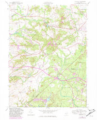
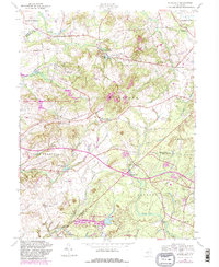
1957 Map of Roosevelt
USGS Topo · Published 1982About this map
The borough of Roosevelt sits at the heart of this central New Jersey landscape, which was updated in the early 1980s to reflect suburban expansion near the Interchange 16 corridor. This area, spanning the border of Mercer, Monmouth, and Ocean Counties, preserves an older network of rural crossroads and hamlets such as Perrineville, Stone Tavern, and Carrs Tavern. The presence of numerous country houses of worship, including United Ch, St Josephs Ch, and Debows Ch, points to a long-established community structure that predates the modern residential developments.
Find a feature on this map
51 named features on this map. Tap any name to fly to it.
Don’t see what you’re looking for? This feature index may not catch every label — zoom into the map to look around manually.
Map Details
Editions of this 1957 Roosevelt Map
5 editions found
Other maps of this area

1888 · Bordentown
USGS Topo · 1:62,500

1888 · New Brunswick
USGS Topo · 1:62,500

1888 · Princeton
USGS Topo · 1:62,500

1888 · Cassville
USGS Topo · 1:62,500

1893 · Bordentown
USGS Topo · 1:62,500

1893 · New Brunswick
USGS Topo · 1:62,500

1894 · Princeton
USGS Topo · 1:62,500

1894 · Cassville
USGS Topo · 1:62,500

1900 · Cassville
USGS Topo · 1:62,500

1901 · New Brunswick
USGS Topo · 1:62,500
Featured Places
- Jackson Township, NJ
- Manalapan Township, NJ
- Freehold Township, NJ
- East Windsor Township, NJ
- Millstone Township, NJ