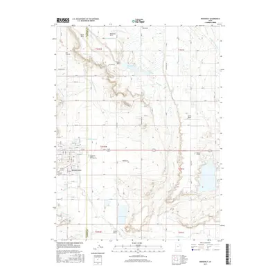
2017 Map of Roosevelt
USGS Topo · Published 2017About this map
Roosevelt and the neighboring community of Ballard anchor this portion of the Uintah Basin, where the landscape is defined by an intricate network of irrigation systems and expansive plateaus. The map documents the vital water infrastructure necessary for this arid region, including the Blackhawk Canal, State Road Lateral, and the Sinka Lateral. These waterways feed the agricultural lands surrounding distinctive terrain features like Nephi Bench and Blackhawk Bench. Educational and community hubs are central to the local geography, notably the Uintah Basin Applied Technology Coll and Roosevelt Memorial Park. To the east, the topography transitions toward Bottle Hollow and the W Channel Uinta River, while local storage is provided by the Montes Cr Reservoir and Lynn Haslem Reservoir. The survey reveals a structured grid of rural roads and laterals that have shaped development across Duchesne Co and Uintah Co.
Find a feature on this map
55 named features on this map. Tap any name to fly to it.
Don’t see what you’re looking for? This feature index may not catch every label — zoom into the map to look around manually.
Map Details
Editions of this 2017 Roosevelt Map
This is the sole edition of this map. No revisions or reprints were ever made.
Other maps of this area

1885 · Ashley
USGS Topo · 1:250,000

1885 · Uinta
USGS Topo · 1:250,000

1917 · Vernal
USGS Topo · 1:125,000

1939 · Duchesne
USGS Topo · 1:125,000

1954 · Salt Lake City
USGS Topo · 1:250,000

1954 · Vernal
USGS Topo · 1:250,000

1958 · Vernal
USGS Topo · 1:250,000

1958 · Salt Lake City
USGS Topo · 1:250,000

1960 · Salt Lake City
USGS Topo · 1:250,000

1960 · Vernal
USGS Topo · 1:250,000