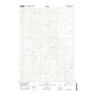
2017 Map of Rooster Comb Peak
USGS Topo · Published 2017About this map
Rooster Comb Peak rises as the central landmark of this high-elevation landscape in Owyhee County, where deep drainages like Johnston Draw and Wood Road Gulch carve into the high Idaho plateau. The terrain is defined by its water sources, including high-country springs such as Crows Nest Spring and Babbington Spring Number 2. These water points and sheltered spots like Chipmunk Meadow and China Flat reveal the logistical patterns of range life in the Great Basin’s northern edge.
Find a feature on this map
45 named features on this map. Tap any name to fly to it.
Don’t see what you’re looking for? This feature index may not catch every label — zoom into the map to look around manually.
Map Details
Editions of this 2017 Rooster Comb Peak Map
This is the sole edition of this map. No revisions or reprints were ever made.
Other maps of this area

1892 · Silver City
USGS Topo · 1:125,000

1894 · Silver City
USGS Topo · 1:125,000

1898 · Silver City
USGS Topo · 1:125,000

1955 · Boise
USGS Topo · 1:250,000

1957 · Wilson Peak
USGS Topo · 1:24,000

1957 · Sands Basin
USGS Topo · 1:62,500

1958 · Boise
USGS Topo · 1:250,000

1962 · Boise
USGS Topo · 1:250,000

1965 · Rooster Comb Peak
USGS Topo · 1:62,500
1965 · Silver City
USGS Topo · 1:62,500