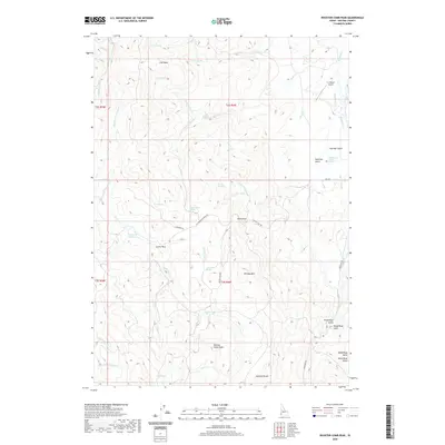
2020 Map of Rooster Comb Peak
USGS Topo · Published 2020About this map
Rooster Comb Peak stands as the central topographic landmark in this high-desert region of Owyhee County, where deep canyons and isolated summits dictate the sparse settlement pattern. The landscape is defined by its complex drainage network, where Succor Cr and Reynolds Cr carve through the high plateaus. Small outposts such as Crows Nest and Coal Bank reflect the area's history of cattle ranching and early commerce, while the Z X Ranch Airport in the northeast corner serves as a modern connection to these remote rangelands.
Find a feature on this map
47 named features on this map. Tap any name to fly to it.
Don’t see what you’re looking for? This feature index may not catch every label — zoom into the map to look around manually.
Map Details
Editions of this 2020 Rooster Comb Peak Map
This is the sole edition of this map. No revisions or reprints were ever made.
Other maps of this area

1892 · Silver City
USGS Topo · 1:125,000

1894 · Silver City
USGS Topo · 1:125,000

1898 · Silver City
USGS Topo · 1:125,000

1955 · Boise
USGS Topo · 1:250,000

1957 · Wilson Peak
USGS Topo · 1:24,000

1957 · Sands Basin
USGS Topo · 1:62,500

1958 · Boise
USGS Topo · 1:250,000

1962 · Boise
USGS Topo · 1:250,000

1965 · Rooster Comb Peak
USGS Topo · 1:62,500
1965 · Silver City
USGS Topo · 1:62,500