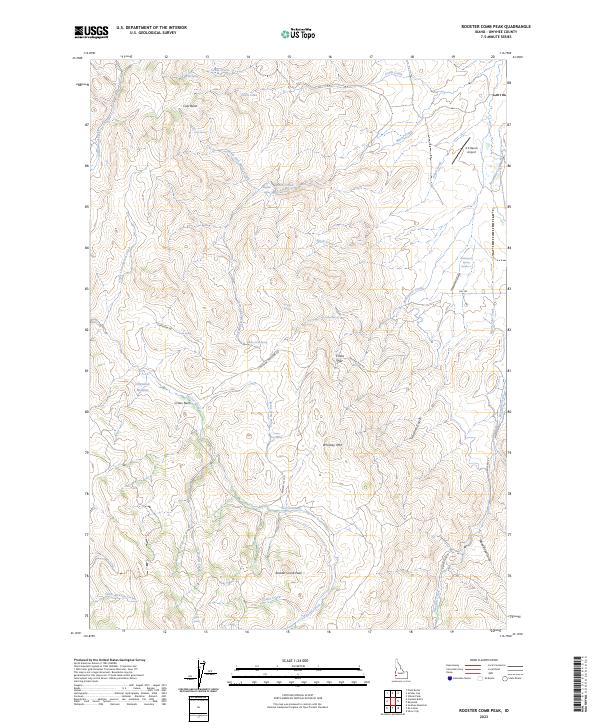
2023 Map of Rooster Comb Peak
USGS Topo · Published 2023About this map
Rooster Comb Peak rises above a complex drainage system in this high-desert portion of Owyhee County. The landscape is defined by its numerous springs and seasonal watercourses, including Macks Creek, Succor Creek, and Reynolds Creek, which have carved deep gulches like Hamilton Gulch and Gardner Gulch. Human presence in this isolated terrain is marked by the remote Z X Ranch Airport and a network of primitive routes such as Chipmunk Rd and Whiskey Hill Rd. Small bodies of water like Cottle Lake and named springs such as Boghole Spring and Gold Spring provide critical watering points in an otherwise arid environment. The map details the transition from the flat expanse of China Flat to the prominent heights of Whiskey Mtn, offering a precise view of the topography used by ranchers and hunters in the early twenty-first century.
Find a feature on this map
45 named features on this map. Tap any name to fly to it.
Don’t see what you’re looking for? This feature index may not catch every label — zoom into the map to look around manually.
Map Details
Editions of this 2023 Rooster Comb Peak Map
This is the sole edition of this map. No revisions or reprints were ever made.
Other maps of this area

1892 · Silver City
USGS Topo · 1:125,000

1894 · Silver City
USGS Topo · 1:125,000

1898 · Silver City
USGS Topo · 1:125,000

1955 · Boise
USGS Topo · 1:250,000

1957 · Wilson Peak
USGS Topo · 1:24,000

1957 · Sands Basin
USGS Topo · 1:62,500

1958 · Boise
USGS Topo · 1:250,000

1962 · Boise
USGS Topo · 1:250,000

1965 · Rooster Comb Peak
USGS Topo · 1:62,500
1965 · Silver City
USGS Topo · 1:62,500