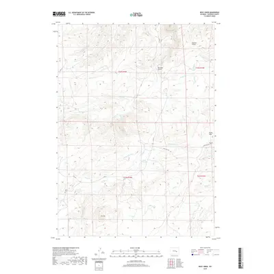
2018 Map of Root Creek
USGS Topo · Published 2018About this map
Grant Cem and the nearby Grant Springs mark the western reaches of this high-country landscape in Converse County. The terrain is defined by a dense network of drainages and prominent peaks, with Lacy Mtn anchoring the southern portion of the survey. Numerous named watercourses, including the W Fork Hunton Cr and Box Elder Cr, have carved deep depressions such as Box Elder Canyon and Brighton Canyon into the plateau.
Find a feature on this map
39 named features on this map. Tap any name to fly to it.
Don’t see what you’re looking for? This feature index may not catch every label — zoom into the map to look around manually.
Map Details
Editions of this 2018 Root Creek Map
This is the sole edition of this map. No revisions or reprints were ever made.
Other maps of this area

1949 · Careyhurst
USGS Topo · 1:24,000

1949 · Parkerton
USGS Topo · 1:24,000

1949 · Glenrock
USGS Topo · 1:24,000

1950 · Careyhurst
USGS Topo · 1:24,000

1950 · Parkerton
USGS Topo · 1:24,000

1950 · Glenrock
USGS Topo · 1:24,000

1954 · Torrington
USGS Topo · 1:250,000

1958 · Torrington
USGS Topo · 1:250,000

1964 · Buck Peak
USGS Topo · 1:24,000
1964 · Hermit Rock
USGS Topo · 1:24,000