
1964 Map of Buck Peak
USGS Topo · Published 1967About this map
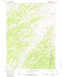
Medicine Bow National Forest dominates the landscape of this mid-1960s Wyoming survey, where the drainages of Buck Creek and Elder Box Creek carve through high-elevation terrain. The presence of Box Elder Sch and scattered homesteads like Snowshoe Ranch and the Buck Place indicate a persistent ranching footprint in the foothills of Buck Peak. The map reveals a network of primitive transportation essential for land management and local life, featuring both a Jeep Trail and a Pack Trail crossing the slopes. Notable high points including Lookout Peak, Davis Peak, and Pole Mtn provided strategic vantage points over the intricate creek systems like Aunt Ag Creek and Strawberry Creek. These features illustrate the intersection of federal forest management and private landholdings in Converse County during an era of continued rural utility.
Find a feature on this map
31 named features on this map. Tap any name to fly to it.
Don’t see what you’re looking for? This feature index may not catch every label — zoom into the map to look around manually.
Map Details
Editions of this 1964 Buck Peak Map
3 editions found
Other maps of this area

1954 · Torrington
USGS Topo · 1:250,000

1955 · Casper
USGS Topo · 1:250,000

1958 · Casper
USGS Topo · 1:250,000

1958 · Torrington
USGS Topo · 1:250,000

1959 · Squaw Spring
USGS Topo · 1:24,000

1960 · Banner Mtn
USGS Topo · 1:24,000

1960 · Reno Hill
USGS Topo · 1:24,000

1962 · Casper
USGS Topo · 1:250,000

1964 · Buffalo Peak
USGS Topo · 1:24,000
1964 · Protsmans Knob
USGS Topo · 1:24,000