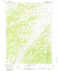
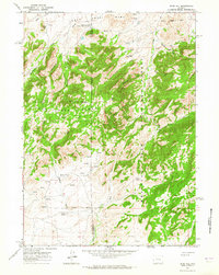
1964 Map of Buck Peak
USGS Topo · Published 1980About this map
Medicine Bow National Forest dominates this landscape in southern Converse County, where the high ridges of the Laramie Mountains transition into a network of steep drainages. The 1960s terrain is marked by isolated rural outposts such as Snowshoe Ranch and the Buck Place, reflecting the ranching heritage of this high-altitude region. Topographical landmarks like Buck Peak, Davis Peak, and Lookout Peak provide vertical orientation for the numerous creeks—including Box Elder Creek and Gunnysack Creek—that carve through the forest. Evidence of early local infrastructure is visible at the Box Elder Sch, situated near the confluence of Box Elder Draw and Keely Creek. A Jeep Trail provides one of the few improved routes through the timbered slopes, connecting the higher elevations near Pole Mtn to the valleys below.
Find a feature on this map
28 named features on this map. Tap any name to fly to it.
Don’t see what you’re looking for? This feature index may not catch every label — zoom into the map to look around manually.
Map Details
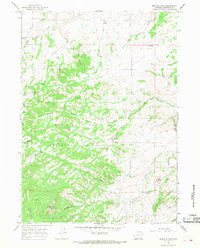
Editions of this 1964 Buck Peak Map
3 editions found
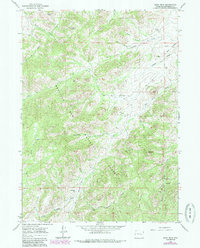
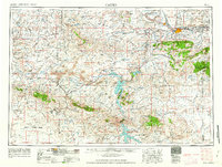
Other maps of this area

1954 · Torrington
USGS Topo · 1:250,000

1955 · Casper
USGS Topo · 1:250,000

1958 · Casper
USGS Topo · 1:250,000

1958 · Torrington
USGS Topo · 1:250,000
1959 · Squaw Spring
USGS Topo · 1:24,000
1960 · Banner Mtn
USGS Topo · 1:24,000
1960 · Reno Hill
USGS Topo · 1:24,000
1962 · Casper
USGS Topo · 1:250,000
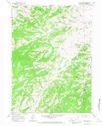
1964 · Buck Peak
USGS Topo · 1:24,000
1964 · Buffalo Peak
USGS Topo · 1:24,000