
1960 Map of Reno Hill
USGS Topo · Published 1965About this map
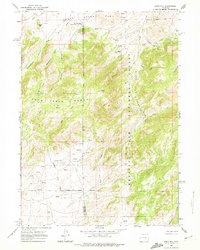
High-altitude ranching and sheep camps define this 1960 landscape along the border of Natrona and Converse counties. The Medicine Bow National Forest covers much of the Deer Creek Range, where terrain is deeply incised by Sensebaugh Canyon, Moonshine Canyon, and Rainbow Canyon. Cultural markers of early 20th-century land use are scattered throughout the quadrangle, including the Old Tobin Place (Banner Ranch Cow Camp) and the Barker Sheep Camp located north of Reno Hill. Evidence of human activity persists even in remote corners, from the Spider settlement in the southwest to the Stewart Ranch near the forest boundary. Historical investigators will note the presence of Ruins and a Prospect, suggesting localized mineral exploration and former homestead sites that predate the mid-century aerial surveys used to compile this data.
Find a feature on this map
28 named features on this map. Tap any name to fly to it.
Don’t see what you’re looking for? This feature index may not catch every label — zoom into the map to look around manually.
Map Details
Editions of this 1960 Reno Hill Map
3 editions found
Other maps of this area

1954 · Torrington
USGS Topo · 1:250,000

1955 · Casper
USGS Topo · 1:250,000

1958 · Casper
USGS Topo · 1:250,000

1958 · Torrington
USGS Topo · 1:250,000

1959 · Squaw Spring
USGS Topo · 1:24,000

1959 · Bates Creek Reservoir
USGS Topo · 1:24,000

1960 · Ice Cave Mountain
USGS Topo · 1:24,000

1960 · Banner Mtn
USGS Topo · 1:24,000
1960 · Otter Creek
USGS Topo · 1:24,000

1962 · Casper
USGS Topo · 1:250,000