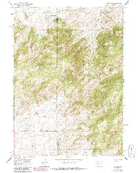
1960 Map of Reno Hill
USGS Topo · Published 1985About this map
The Deer Creek Range dominates this portion of the Medicine Bow National Forest, straddling the border between Natrona and Converse Counties. The map reveals a landscape defined by seasonal pastoral use and early ranching, evidenced by the Old Tobin Place (Banner Ranch Cow Camp) and Barker Sheep Camp tucked into the high drainages. These sites, along with the Stewart Ranch, indicate a livestock-based economy that utilized the complex canyon systems of Sensebaugh Canyon and Moonshine Canyon for shelter and water.
Find a feature on this map
32 named features on this map. Tap any name to fly to it.
Don’t see what you’re looking for? This feature index may not catch every label — zoom into the map to look around manually.
Map Details
Editions of this 1960 Reno Hill Map
3 editions found
Other maps of this area

1954 · Torrington
USGS Topo · 1:250,000

1955 · Casper
USGS Topo · 1:250,000

1958 · Casper
USGS Topo · 1:250,000

1958 · Torrington
USGS Topo · 1:250,000

1959 · Squaw Spring
USGS Topo · 1:24,000

1959 · Bates Creek Reservoir
USGS Topo · 1:24,000

1960 · Ice Cave Mountain
USGS Topo · 1:24,000

1960 · Banner Mtn
USGS Topo · 1:24,000
1960 · Otter Creek
USGS Topo · 1:24,000

1960 · Reno Hill
USGS Topo · 1:24,000