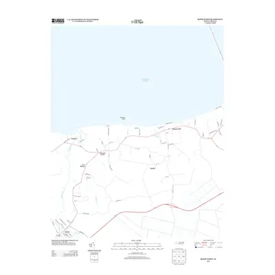
2013 Map of Roper North
USGS Topo · Published 2013About this map
Batemans Beach and the shoreline of the Atlantic Ocean define the northern edge of this coastal North Carolina landscape. This 2013 survey records a network of rural settlements and agricultural corridors, including the primary community of Roper in the southwest corner and Mackeys along the banks of Mackeys Cr. The presence of S Lees Saw Mills near the junction of Kendrick Cr and the Main Canal points to the area's long-standing reliance on timber and water-based transit.
Find a feature on this map
63 named features on this map. Tap any name to fly to it.
Don’t see what you’re looking for? This feature index may not catch every label — zoom into the map to look around manually.
Map Details
Editions of this 2013 Roper North Map
This is the sole edition of this map. No revisions or reprints were ever made.
Other maps of this area

1904 · Edenton
USGS Topo · 1:62,500

1906 · Hertford
USGS Topo · 1:62,500

1940 · Hertford
USGS Topo · 1:62,500

1942 · Edenton
USGS Topo · 1:62,500

1943 · Columbia
USGS Topo · 1:125,000

1943 · Plymouth
USGS Topo · 1:125,000

1943 · Edenton
USGS Topo · 1:62,500

1953 · Norfolk
USGS Topo · 1:250,000

1953 · Rocky Mount
USGS Topo · 1:250,000

1954 · Rocky Mount
USGS Topo · 1:250,000