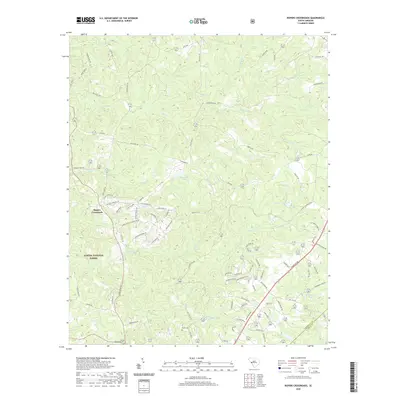
2020 Map of Ropers Crossroads
USGS Topo · Published 2020About this map
The community of Ropers Crossroads serves as a central landmark in this portion of South Carolina, where the transition between Sumter National Forest and private landholdings is clearly delineated. The terrain is defined by a dense network of tributaries including Horn Cr, Cheves Cr, and Monday Br, which carve through the landscape toward larger basins. Family and local history is anchored by the presence of the Horrie Cem and Young Macedonia Cem, providing essential points of reference for genealogical research in this rural corridor.
Find a feature on this map
93 named features on this map. Tap any name to fly to it.
Don’t see what you’re looking for? This feature index may not catch every label — zoom into the map to look around manually.
Map Details
Editions of this 2020 Ropers Crossroads Map
This is the sole edition of this map. No revisions or reprints were ever made.
Other maps of this area

1892 · Mc Cormick
USGS Topo · 1:125,000

1912 · Mc Cormick
USGS Topo · 1:125,000

1920 · Clarks Hill
USGS Topo · 1:48,000

1921 · Clarks Hill
USGS Topo · 1:62,500

1923 · Warrenville
USGS Topo · 1:48,000

1928 · Warrenville
USGS Topo · 1:62,500

1941 · Clarks Hill
USGS Topo · 1:62,500

1942 · Clarks Hill
USGS Topo · 1:62,500

1943 · Warrenville
USGS Topo · 1:62,500

1953 · Athens
USGS Topo · 1:250,000