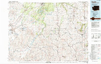
1984 Map of Rosalia
USGS Topo · Published 1984About this map
Eastern Washington University stands at the northern edge of this Palouse landscape, marking the academic hub of Cheney as it appeared in the mid-1980s. The region is defined by its transition from the water-rich scablands of the Turnbull National Wildlife Refuge to the deep-soil wheat country of the south. This era shows a complex transportation network with the Burlington Northern, Union Pacific, and Milwaukee Road railroads all threading through the rolling hills to serve agricultural centers like Rosalia, St John, and Tekoa. The terrain is punctuated by significant volcanic remnants, most notably Steptoe Butte, which rises sharply above the surrounding fields within Steptoe Butte State Park. Notable water features including the long, narrow reach of Rock Lake and the winding course of Hangman Creek dictate the placement of smaller settlements like Pine City and Ewan along the drainage basins of the Palouse.
Find a feature on this map
68 named features on this map. Tap any name to fly to it.
Don’t see what you’re looking for? This feature index may not catch every label — zoom into the map to look around manually.
Map Details
Editions of this 1984 Rosalia Map
This is the sole edition of this map. No revisions or reprints were ever made.
Other maps of this area

1901 · Spokane
USGS Topo · 1:125,000

1903 · Oakesdale
USGS Topo · 1:125,000

1903 · Rathdrum
USGS Topo · 1:125,000

1905 · Oakesdale
USGS Topo · 1:125,000

1910 · Pullman
USGS Topo · 1:125,000

1943 · Medical Lake
USGS Topo · 1:62,500

1945 · Reardan
USGS Topo · 1:62,500

1949 · Greenacres
USGS Topo · 1:62,500

1950 · La Crosse
USGS Topo · 1:62,500

1950 · Spokane SE
USGS Topo · 1:24,000