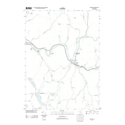
2013 Map of Roscoe
USGS Topo · Published 2013About this map
Beaver Kill and Willowemoc Cr converge near the settlement of Roscoe, a geographic point famous for its connection to the American fly-fishing tradition. This 2013 survey illustrates the modern landscape of the Catskill foothills, highlighting the transport corridor of Route 17 as it follows the winding river valleys. The map documents numerous smaller settlements such as Rockland, Cooks Falls, and Butternut Grove, alongside recreational landmarks like Camp Highmount and Skytop Airport. Family history researchers can locate local burial grounds including Bonaire Cem and Riverview Cem, while the intricate network of mountain roads—such as Old Route 17 and Berry Hill Rd—reveals the development of these rural Sullivan County communities. The terrain is marked by distinctive features like The Punchbowl and Stadel Mountain, providing a clear view of the area's hydrology and topography.
Find a feature on this map
86 named features on this map. Tap any name to fly to it.
Don’t see what you’re looking for? This feature index may not catch every label — zoom into the map to look around manually.
Map Details
Editions of this 2013 Roscoe Map
This is the sole edition of this map. No revisions or reprints were ever made.
Other maps of this area

1920 · Long Eddy
USGS Topo · 1:62,500

1921 · Long Eddy
USGS Topo · 1:48,000

1921 · Livingston Manor
USGS Topo · 1:62,500

1922 · Andes
USGS Topo · 1:62,500

1923 · Long Eddy
USGS Topo · 1:62,500

1923 · Walton
USGS Topo · 1:48,000

1923 · Livingston Manor
USGS Topo · 1:62,500

1924 · Andes
USGS Topo · 1:62,500

1925 · Walton
USGS Topo · 1:62,500

1943 · Honesdale
USGS Topo · 1:125,000