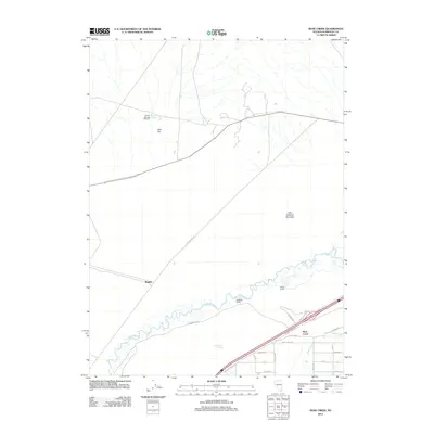
2011 Map of Rose Creek
USGS Topo · Published 2011About this map
The Humboldt River winds through this Great Basin corridor, defining the transport and settlement patterns of Humboldt County. Near the river's path, the small community of Rose Creek serves as a modern focal point, situated at the junction of several local routes like W Rose Creek Rd and Heckman Dr. The map reveals a landscape balancing riparian life with arid flats, such as Abel Flat, where water sources like Barrett Springs and Little Alkali Spring were vital for the region's ranching heritage.
Find a feature on this map
27 named features on this map. Tap any name to fly to it.
Don’t see what you’re looking for? This feature index may not catch every label — zoom into the map to look around manually.
Map Details
Editions of this 2011 Rose Creek Map
This is the sole edition of this map. No revisions or reprints were ever made.
Other maps of this area

1882 · Paradise
USGS Topo · 1:250,000

1886 · Disaster
USGS Topo · 1:250,000

1893 · Paradise
USGS Topo · 1:250,000

1893 · Disaster
USGS Topo · 1:250,000

1931 · Lovelock
USGS Topo · 1:250,000

1932 · Sonoma Range
USGS Topo · 1:250,000

1935 · Lovelock
USGS Topo · 1:250,000

1939 · Sonoma Range
USGS Topo · 1:250,000

1939 · Eugene Mountains Area
USGS Topo · 1:62,500

1942 · Eugene Mountains Area
USGS Topo · 1:62,500