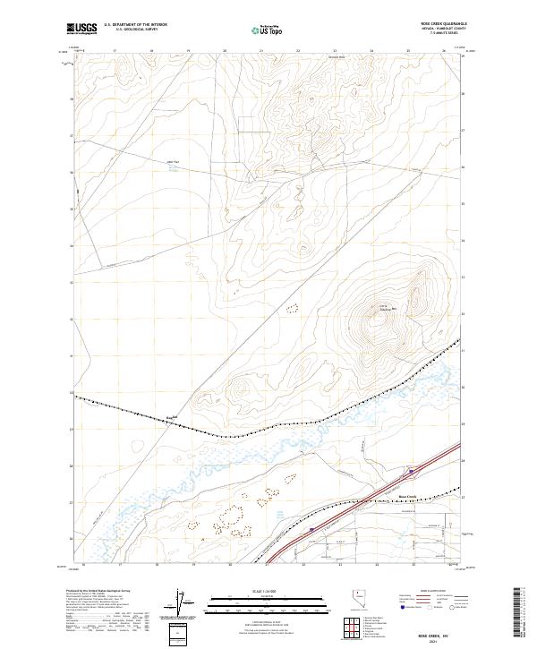
2021 Map of Rose Creek
USGS Topo · Published 2021About this map
The Humboldt River winds through this Great Basin landscape, defining the character of the river valley near the settlement of Rose Creek. This area of Humboldt County serves as a vital transportation corridor, where the Southern Pacific Company RR and several roads, including Jungo Rd and Conservation Rd, parallel the river's path. The topography rises away from the water into the Tenmile Hills and toward the summit of Little Tabletop Mtn, while the level expanse of Abel Flat sits to the northwest.
Find a feature on this map
30 named features on this map. Tap any name to fly to it.
Don’t see what you’re looking for? This feature index may not catch every label — zoom into the map to look around manually.
Map Details
Editions of this 2021 Rose Creek Map
This is the sole edition of this map. No revisions or reprints were ever made.
Other maps of this area

1882 · Paradise
USGS Topo · 1:250,000

1886 · Disaster
USGS Topo · 1:250,000

1893 · Paradise
USGS Topo · 1:250,000

1893 · Disaster
USGS Topo · 1:250,000

1931 · Lovelock
USGS Topo · 1:250,000

1932 · Sonoma Range
USGS Topo · 1:250,000

1935 · Lovelock
USGS Topo · 1:250,000

1939 · Sonoma Range
USGS Topo · 1:250,000

1939 · Eugene Mountains Area
USGS Topo · 1:62,500

1942 · Eugene Mountains Area
USGS Topo · 1:62,500