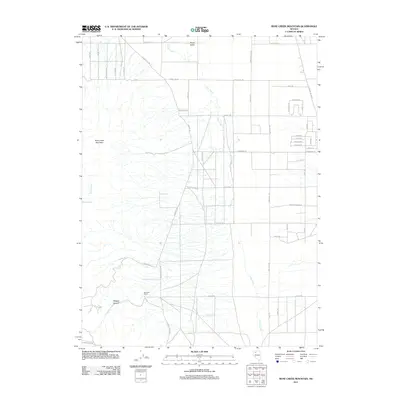
2011 Map of Rose Creek Mountain
USGS Topo · Published 2011About this map
Rose Creek Mountain dominates the western landscape of this Nevada terrain, where the high desert transitions into the broad expanse of Grass Valley. The 2011 survey documents a mix of traditional ranching heritage and modern rural development, centered around the Herschell Ranch and a network of roads that service the basin. Water, always critical in this environment, is traced through the seasonal paths of Clear Creek and Rose Creek, with Rose Spring marking a vital natural point in the arid foothills. The map reveals the structured expansion of the area via names like Beechcraft Blvd and S Grass Valley Rd, illustrating how modern infrastructure has been overlaid onto the older geography of Badger Canyon and the surrounding alluvial fans.
Find a feature on this map
51 named features on this map. Tap any name to fly to it.
Don’t see what you’re looking for? This feature index may not catch every label — zoom into the map to look around manually.
Map Details
Editions of this 2011 Rose Creek Mountain Map
This is the sole edition of this map. No revisions or reprints were ever made.
Other maps of this area

1932 · Sonoma Range
USGS Topo · 1:250,000

1939 · Sonoma Range
USGS Topo · 1:250,000

1955 · Winnemucca
USGS Topo · 1:250,000

1958 · Winnemucca
USGS Topo · 1:250,000

1958 · Winnemucca
USGS Topo · 1:62,500

1958 · Rose Creek
USGS Topo · 1:62,500

1961 · Leach Hot Springs
USGS Topo · 1:62,500

1961 · Dun Glen
USGS Topo · 1:62,500

1962 · Winnemucca
USGS Topo · 1:250,000
1975 · Winnemucca NW
USGS Topo · 1:24,000