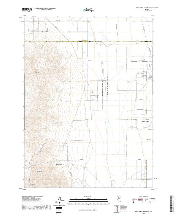
2021 Map of Rose Creek Mountain
USGS Topo · Published 2021About this map
East Range dominates the western portion of this Pershing and Humboldt County borderlands survey, rising toward the distinct summit of Auld Lang Syne Peak. This high-desert landscape is defined by the sharp transition from the mountainous western heights down into the wide alluvial expanse of Grass Valley. Mining legacy is evidenced by access routes such as Jupiter Mine Rd and Auburn Mine Rd, which lead into the rugged canyons. Water sources are scarce but critical, with Rose Spring and seasonal drainages like Clear Creek and Sonoma Creek providing the primary hydrologic features. The northeastern corner shows a developing grid of rural residential roads including Cormier Blvd and W Tycana Rd, illustrating the modern expansion of settlement into the valley floor while the high terrain of Rose Creek Mountain remains largely undeveloped.
Find a feature on this map
63 named features on this map. Tap any name to fly to it.
Don’t see what you’re looking for? This feature index may not catch every label — zoom into the map to look around manually.
Map Details
Editions of this 2021 Rose Creek Mountain Map
This is the sole edition of this map. No revisions or reprints were ever made.
Other maps of this area

1932 · Sonoma Range
USGS Topo · 1:250,000

1939 · Sonoma Range
USGS Topo · 1:250,000

1955 · Winnemucca
USGS Topo · 1:250,000

1958 · Winnemucca
USGS Topo · 1:250,000

1958 · Winnemucca
USGS Topo · 1:62,500

1958 · Rose Creek
USGS Topo · 1:62,500

1961 · Leach Hot Springs
USGS Topo · 1:62,500

1961 · Dun Glen
USGS Topo · 1:62,500

1962 · Winnemucca
USGS Topo · 1:250,000
1975 · Winnemucca NW
USGS Topo · 1:24,000