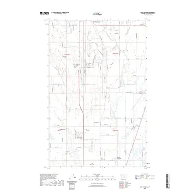
2020 Map of Rose Crossing
USGS Topo · Published 2020About this map
The Flathead Valley serves as a critical corridor between the northern edge of Kalispell and the southern reaches of Whitefish in this contemporary record. The landscape is defined by the hydrologic network of the Stillwater River and the winding Whitefish River, which is crossed by the Whitefish River Bridge near the small settlement of Rose Xing. The map reveals the expansion of residential roads and subdivisions reaching toward the southern foothills of the Whitefish Range, contrasting the agricultural foundations of the valley with modern infrastructure.
Find a feature on this map
102 named features on this map. Tap any name to fly to it.
Don’t see what you’re looking for? This feature index may not catch every label — zoom into the map to look around manually.
Map Details
Editions of this 2020 Rose Crossing Map
This is the sole edition of this map. No revisions or reprints were ever made.
Other maps of this area

1943 · Kalispell
USGS Topo · 1:125,000

1957 · Kalispell
USGS Topo · 1:250,000

1960 · Kalispell
USGS Topo · 1:250,000

1961 · Kalispell
USGS Topo · 1:250,000

1962 · Columbia Falls South
USGS Topo · 1:24,000

1962 · Rose Crossing
USGS Topo · 1:24,000

1962 · Blue Grass Ridge
USGS Topo · 1:24,000

1962 · Beaver Lake
USGS Topo · 1:24,000

1962 · Creston
USGS Topo · 1:24,000

1962 · Rhodes
USGS Topo · 1:24,000