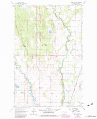
1982 Map of Rose Crossing
USGS Topo · Published 1983About this map
Midway Grange sits amidst the fertile river valley terrain of northwestern Montana, where the winding courses of the Whitefish River and Stillwater River converge. The landscape is defined by the intersection of forest and field, particularly within the Stillwater Forest, which occupies the western hillsides. This 1982 photorevised survey illustrates a transitional period for the area, capturing the footprint of the Glacier Park International Airport and the expanding infrastructure near the Burlington Northern railroad lines. Settlement patterns follow the river banks and the primary corridors, punctuated by rural institutions such as the Pine Grove Sch, Helena Flats Sch, and Birch Grove Sch. These schools, along with the Apostolic Ch and Trinity Cem, suggest a well-established agricultural community maintaining its local identity even as regional transportation hubs grew nearby.
Find a feature on this map
1 named feature on this map. Tap any name to fly to it.
Don’t see what you’re looking for? This feature index may not catch every label — zoom into the map to look around manually.
Map Details
Editions of this 1982 Rose Crossing Map
This is the sole edition of this map. No revisions or reprints were ever made.
Other maps of this area

1943 · Kalispell
USGS Topo · 1:125,000

1957 · Kalispell
USGS Topo · 1:250,000

1960 · Kalispell
USGS Topo · 1:250,000

1961 · Kalispell
USGS Topo · 1:250,000

1962 · Columbia Falls South
USGS Topo · 1:24,000

1962 · Rose Crossing
USGS Topo · 1:24,000

1962 · Blue Grass Ridge
USGS Topo · 1:24,000

1962 · Beaver Lake
USGS Topo · 1:24,000

1962 · Creston
USGS Topo · 1:24,000

1962 · Rhodes
USGS Topo · 1:24,000