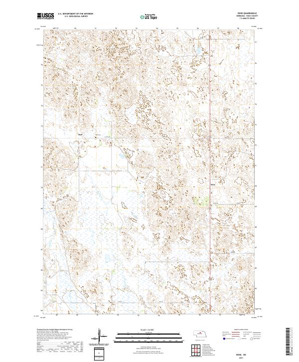
2021 Map of Rose
USGS Topo · Published 2021About this map
Rose and Duff anchor this Nebraska landscape, where the Sandhills terrain is defined by a complex network of wetlands and intermittent watercourses. The local hydrology is characterized by the winding paths of Bloody Cr and Skull Cr, which navigate the depressions between low-lying dunes and ridges. For those researching family ties to Rock County, the Duff Cem remains a primary landmark along 444th Ave, serving as a central point for the small community of Duff. The road network, including Freedom Ave and Fawn Rd, follows a strict section-line grid that overlays the natural topography, illustrating the enduring influence of the Public Land Survey System on the settlement patterns of the Nebraska plains. This survey captures the region's sparse residential character and its reliance on the natural drainage basins that sustain the local ranching environment.
Find a feature on this map
18 named features on this map. Tap any name to fly to it.
Don’t see what you’re looking for? This feature index may not catch every label — zoom into the map to look around manually.
Map Details
Editions of this 2021 Rose Map
This is the sole edition of this map. No revisions or reprints were ever made.
Other maps of this area

1955 · O'Neill
USGS Topo · 1:250,000

1959 · O'Neill
USGS Topo · 1:250,000

1969 · O'Neill
USGS Topo · 1:250,000

1981 · Boiling Spring
USGS Topo · 1:24,000

1981 · Stonehouse Ranch NW
USGS Topo · 1:24,000
1981 · Shovel Dot Ranch
USGS Topo · 1:24,000

1981 · Paramount Valley
USGS Topo · 1:24,000
1981 · Stonehouse Ranch SW
USGS Topo · 1:24,000

1981 · Rose
USGS Topo · 1:24,000

1982 · Stockdale Lake
USGS Topo · 1:24,000