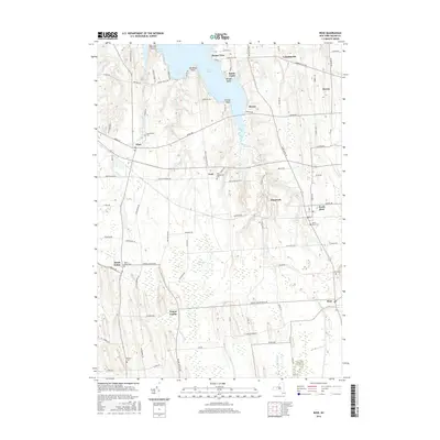
2016 Map of Rose
USGS Topo · Published 2016About this map
Sodus Bay defines the northern reaches of this New York landscape, its irregular shoreline marked by prominent points such as Thornton Point and Nicholas Point. In the mid-2010s, the area reflects a mix of lakeside residential enclaves like Sunset View and Bonni Castle alongside established rural hamlets. The map is particularly dense with genealogical markers, including numerous burial grounds like York Settlement Cem and Espenschied Cem, which anchor the small crossroads communities. Moving south, the terrain transitions into the significant Huckleberry Swamp, where Black Brook and Mervin Brook drain through low-lying wetlands. Historical settlement patterns are evident in the placement of Wayne Center, Glenmark, and Alton, all connected by a grid of local routes like Ridge Rd and the Shaker Tract Rd, which hints at the region's earlier agricultural and communal history.
Find a feature on this map
94 named features on this map. Tap any name to fly to it.
Don’t see what you’re looking for? This feature index may not catch every label — zoom into the map to look around manually.
Map Details
Editions of this 2016 Rose Map
This is the sole edition of this map. No revisions or reprints were ever made.
Other maps of this area

1899 · Palmyra
USGS Topo · 1:62,500

1902 · Sodus Bay
USGS Topo · 1:62,500

1902 · Pultneyville
USGS Topo · 1:62,500

1902 · Clyde
USGS Topo · 1:62,500

1902 · Palmyra
USGS Topo · 1:62,500

1943 · Lyons
USGS Topo · 1:31,680

1943 · Sodus Point
USGS Topo · 1:31,680

1943 · Savannah
USGS Topo · 1:31,680

1943 · Sodus
USGS Topo · 1:31,680

1943 · Wolcott
USGS Topo · 1:31,680