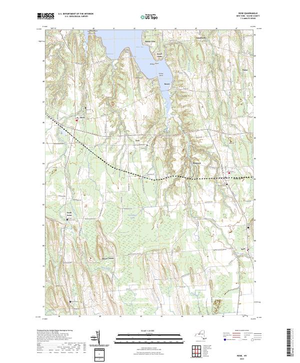
2023 Map of Rose
USGS Topo · Published 2023About this map
Sodus Bay and its intricate shoreline dominate the northern reaches of this Wayne County landscape, where points like Willigs Point and Grassy Point extend into the water. This modern survey illustrates a deeply rooted rural layout characterized by dispersed hamlets and a significant number of family and community burial grounds, including the York Settlement Cem and Alton Cem. The interior terrain is defined by the extensive Huckleberry Swamp, which occupies a large portion of the central lowlands between Wayne Center and the village of Rose. This wetland system feeds several local watercourses, such as Black Brook and Sodus Creek, which wind through a mosaic of agricultural plots and small settlements like York and Glenmark. The road network follows the long-established surveyor lines of western New York, connecting the northern shore at Sunset View to the crossroads at South Sodus.
Find a feature on this map
99 named features on this map. Tap any name to fly to it.
Don’t see what you’re looking for? This feature index may not catch every label — zoom into the map to look around manually.
Map Details
Editions of this 2023 Rose Map
This is the sole edition of this map. No revisions or reprints were ever made.
Other maps of this area

1899 · Palmyra
USGS Topo · 1:62,500

1902 · Sodus Bay
USGS Topo · 1:62,500

1902 · Pultneyville
USGS Topo · 1:62,500

1902 · Clyde
USGS Topo · 1:62,500

1902 · Palmyra
USGS Topo · 1:62,500

1943 · Lyons
USGS Topo · 1:31,680

1943 · Sodus Point
USGS Topo · 1:31,680

1943 · Savannah
USGS Topo · 1:31,680

1943 · Sodus
USGS Topo · 1:31,680

1943 · Wolcott
USGS Topo · 1:31,680