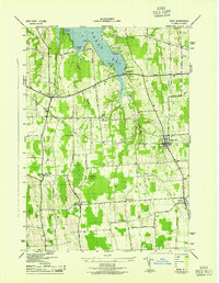
1943 Map of Rose
USGS Topo · Published 1943About this map
Sodus Bay dominates the northern landscape of this Wayne County survey, with its intricate shoreline defined by Thornton Pt, Hunter Pt, and the sheltered waters of Sawmill Cove. The region's mid-century rural character is evidenced by a dense network of district schools, from Sch No 4 near the bay to School No 8 further south, marking the social centers of these farming communities. The Sodus Bay Branch of the railroad cuts through the terrain, supporting the agricultural economy of North Rose and Rose.
Find a feature on this map
54 named features on this map. Tap any name to fly to it.
Don’t see what you’re looking for? This feature index may not catch every label — zoom into the map to look around manually.
Map Details
Editions of this 1943 Rose Map
This is the sole edition of this map. No revisions or reprints were ever made.
Other maps of this area

1899 · Palmyra
USGS Topo · 1:62,500

1902 · Sodus Bay
USGS Topo · 1:62,500

1902 · Pultneyville
USGS Topo · 1:62,500

1902 · Clyde
USGS Topo · 1:62,500

1902 · Palmyra
USGS Topo · 1:62,500

1943 · Lyons
USGS Topo · 1:31,680

1943 · Sodus Point
USGS Topo · 1:31,680

1943 · Savannah
USGS Topo · 1:31,680

1943 · Sodus
USGS Topo · 1:31,680

1943 · Wolcott
USGS Topo · 1:31,680