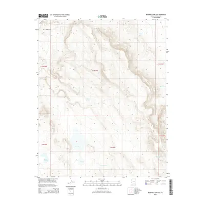
2014 Map of Rose Well Camp East
USGS Topo · Published 2014About this map
Rose Well Camp anchors the northwest corner of this high-desert landscape in Coconino County, characterized by a complex system of water management features essential for ranching and survival in the arid Arizona interior. The terrain is dominated by the expansive basin of Red Lake, flanked by related hydrological points including Red Lake Tank and Little Red Lake.
Find a feature on this map
16 named features on this map. Tap any name to fly to it.
Don’t see what you’re looking for? This feature index may not catch every label — zoom into the map to look around manually.
Map Details
Editions of this 2014 Rose Well Camp East Map
This is the sole edition of this map. No revisions or reprints were ever made.
Other maps of this area

1886 · Chino
USGS Topo · 1:250,000

1891 · Chino
USGS Topo · 1:250,000

1948 · Williams
USGS Topo · 1:250,000

1954 · Williams
USGS Topo · 1:250,000

1956 · Williams
USGS Topo · 1:250,000

1960 · Williams
USGS Topo · 1:250,000

1961 · Williams
USGS Topo · 1:250,000
1980 · Rose Well Camp West
USGS Topo · 1:24,000

1980 · Hazen Hole Tank
USGS Topo · 1:24,000
1980 · Black Tank
USGS Topo · 1:24,000