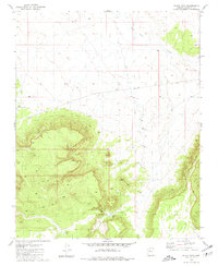
1980 Map of Black Tank
USGS Topo · Published 1981About this map
Black Tank Camp serves as a central point of human activity in this high-desert landscape of Coconino County, mapped in the mid-1970s. The region is defined by a critical network of water management features essential for ranching and survival, ranging from the Farm Dam in the north to the eponymous Black Tank and Little Sullivan Tank. The topography is dominated by the dramatic rise of Long Point, while numerous smaller catchments like Nelson Tank and various Water Tanks are scattered across the terrain to capture seasonal runoff. These features illustrate the practical challenges of sustaining livestock and camps in a territory where permanent water sources, such as the single identified Spring, are rare and highly localized.
Find a feature on this map
10 named features on this map. Tap any name to fly to it.
Don’t see what you’re looking for? This feature index may not catch every label — zoom into the map to look around manually.
Map Details
Editions of this 1980 Black Tank Map
This is the sole edition of this map. No revisions or reprints were ever made.
Other maps of this area

1886 · Chino
USGS Topo · 1:250,000

1891 · Chino
USGS Topo · 1:250,000

1948 · Williams
USGS Topo · 1:250,000

1954 · Williams
USGS Topo · 1:250,000

1956 · Williams
USGS Topo · 1:250,000

1960 · Williams
USGS Topo · 1:250,000

1961 · Williams
USGS Topo · 1:250,000

1980 · Hazen Hole Tank
USGS Topo · 1:24,000
1980 · Tin House
USGS Topo · 1:24,000
1981 · Big Bud Tank
USGS Topo · 1:24,000