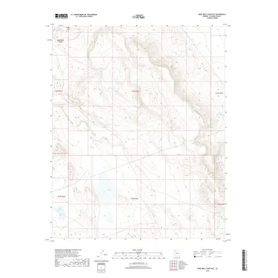
2018 Map of Rose Well Camp East
USGS Topo · Published 2018About this map
Rose Well Camp sits at the northern edge of this high-altitude Coconino County terrain, characterized by a complex network of ephemeral drainage basins and water storage tanks. The landscape is defined by its reliance on collected water, with features such as Rodgers Tank, Ferguson Tank, and the larger Big Sullivan Tank serving as vital landmarks for navigation and land management. The presence of Red Lake and Little Red Lake suggests low-lying catchments that punctuate the otherwise rugged topography. This 2018 survey reveals the meticulous township and range grid system of the U.S. Geological Survey across the Arizona plateau, showing how boundaries like t27n r5w slice through the high country. The land remains largely undeveloped, with water-focused naming conventions like Rodgers Draw and Little Sullivan Tank reflecting the primary points of human interest in this arid environment.
Find a feature on this map
14 named features on this map. Tap any name to fly to it.
Don’t see what you’re looking for? This feature index may not catch every label — zoom into the map to look around manually.
Map Details
Editions of this 2018 Rose Well Camp East Map
This is the sole edition of this map. No revisions or reprints were ever made.
Other maps of this area

1886 · Chino
USGS Topo · 1:250,000

1891 · Chino
USGS Topo · 1:250,000

1948 · Williams
USGS Topo · 1:250,000

1954 · Williams
USGS Topo · 1:250,000

1956 · Williams
USGS Topo · 1:250,000

1960 · Williams
USGS Topo · 1:250,000

1961 · Williams
USGS Topo · 1:250,000
1980 · Rose Well Camp West
USGS Topo · 1:24,000

1980 · Hazen Hole Tank
USGS Topo · 1:24,000
1980 · Black Tank
USGS Topo · 1:24,000