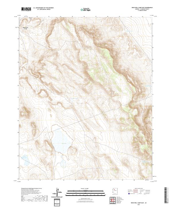
2021 Map of Rose Well Camp East
USGS Topo · Published 2021About this map
Rose Well Camp sits at the northern edge of this arid high-elevation plateau in Coconino County, serving as a rare named point of habitation in a landscape defined by seasonal water management. The topography is shaped by significant drainage systems such as Rodgers Draw, which leads toward several localized water catchments. These catchment features, including Rodgers Tank and Furguson Tank, indicate the historical importance of securing water for livestock and travel in this part of Arizona. Large ephemeral basins like Red Lake and Little Red Lake dominate the southern half of the quadrangle, where the terrain flattens into expansive dry beds. The map also records the eastern extent of Sullivan-named water points with Little Sullivan Tank and Big Sullivan Tank, illustrating the scattered infrastructure of the ranching era.
Find a feature on this map
14 named features on this map. Tap any name to fly to it.
Don’t see what you’re looking for? This feature index may not catch every label — zoom into the map to look around manually.
Map Details
Editions of this 2021 Rose Well Camp East Map
This is the sole edition of this map. No revisions or reprints were ever made.
Other maps of this area

1886 · Chino
USGS Topo · 1:250,000

1891 · Chino
USGS Topo · 1:250,000

1948 · Williams
USGS Topo · 1:250,000

1954 · Williams
USGS Topo · 1:250,000

1956 · Williams
USGS Topo · 1:250,000

1960 · Williams
USGS Topo · 1:250,000

1961 · Williams
USGS Topo · 1:250,000
1980 · Rose Well Camp West
USGS Topo · 1:24,000

1980 · Hazen Hole Tank
USGS Topo · 1:24,000
1980 · Black Tank
USGS Topo · 1:24,000