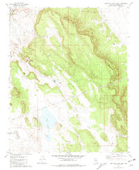
1981 Map of Rose Well Camp East
USGS Topo · Published 1981About this map
Rose Well Camp sits in the northwest corner of this Coconino County landscape, where the high desert terrain is defined by its vital water management infrastructure. The hydrology of the area is centered around Red Lake, a prominent natural catchment supplemented by Red Lake Tank and the seasonal flow of Rodgers Draw. This 1981 survey documents a remote ranching or range management environment where every localized water source is named, from Furguson Tank to the pragmatically titled End of Line Tank (Water). The presence of Debris Basins near Rodgers Tank suggests a landscape active with erosion control and water conservation efforts, typical of the arid Arizona plateau during the late twentieth century. This sheet is particularly useful for understanding the grazing and water-rights history of the region.
Find a feature on this map
13 named features on this map. Tap any name to fly to it.
Don’t see what you’re looking for? This feature index may not catch every label — zoom into the map to look around manually.
Map Details
Editions of this 1981 Rose Well Camp East Map
This is the sole edition of this map. No revisions or reprints were ever made.
Other maps of this area

1886 · Chino
USGS Topo · 1:250,000

1891 · Chino
USGS Topo · 1:250,000

1948 · Williams
USGS Topo · 1:250,000

1954 · Williams
USGS Topo · 1:250,000

1956 · Williams
USGS Topo · 1:250,000

1960 · Williams
USGS Topo · 1:250,000

1961 · Williams
USGS Topo · 1:250,000
1980 · Rose Well Camp West
USGS Topo · 1:24,000

1980 · Hazen Hole Tank
USGS Topo · 1:24,000
1980 · Black Tank
USGS Topo · 1:24,000