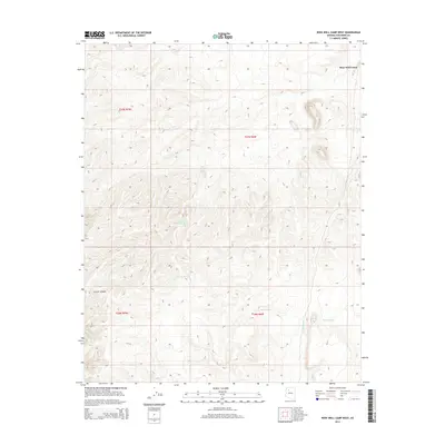
2014 Map of Rose Well Camp West
USGS Topo · Published 2014About this map
Rose Well Camp serves as a lone reference point in this arid stretch of Coconino County, characterized by a series of specialized water catchments essential for ranching or survival in the high desert. The landscape is defined by the drainage of Chino Wash and the distinct formation of Crater Canyon in the southwest. A network of "tubs"—including Wheat Tub, Tub Number One, Tub Number Two, and Tub Number Three—indicates a managed system of water storage, likely utilized for livestock. These man-made or improved water sources, such as Mexican Tank and Tub B, are critical landmarks in a region otherwise marked by isolated terrain and high-elevation contours. The map reflects a modern era of land management where these small-scale features are the primary indicators of human activity and resource utilization across the open range.
Find a feature on this map
13 named features on this map. Tap any name to fly to it.
Don’t see what you’re looking for? This feature index may not catch every label — zoom into the map to look around manually.
Map Details
Editions of this 2014 Rose Well Camp West Map
This is the sole edition of this map. No revisions or reprints were ever made.
Other maps of this area

1886 · Diamond Creek
USGS Topo · 1:250,000

1886 · Chino
USGS Topo · 1:250,000

1891 · Chino
USGS Topo · 1:250,000

1892 · Diamond Creek
USGS Topo · 1:250,000

1948 · Williams
USGS Topo · 1:250,000

1954 · Williams
USGS Topo · 1:250,000

1956 · Williams
USGS Topo · 1:250,000

1960 · Williams
USGS Topo · 1:250,000

1961 · Williams
USGS Topo · 1:250,000
1967 · Frazier Wells
USGS Topo · 1:24,000