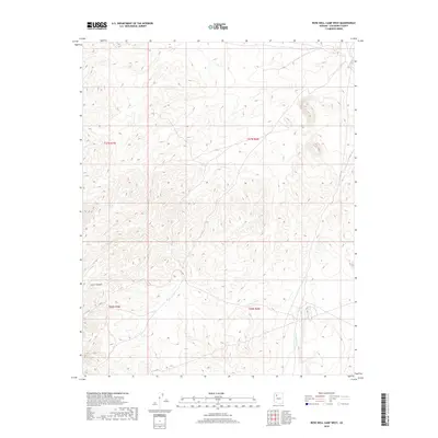
2018 Map of Rose Well Camp West
USGS Topo · Published 2018About this map
Crater Canyon and the winding course of Chino Wash define this section of Coconino County, where the landscape is marked by high-desert drainage patterns. This 2018 survey reveals a terrain devoid of permanent structures or modern settlements, focused instead on the natural topography and the legal boundaries of township and range lines. The transition between t26n r6w and its neighboring sections illustrates a remote part of the Arizona plateau defined primarily by its seasonal watercourses and complex contour intervals.
Find a feature on this map
6 named features on this map. Tap any name to fly to it.
Don’t see what you’re looking for? This feature index may not catch every label — zoom into the map to look around manually.
Map Details
Editions of this 2018 Rose Well Camp West Map
This is the sole edition of this map. No revisions or reprints were ever made.
Other maps of this area

1886 · Diamond Creek
USGS Topo · 1:250,000

1886 · Chino
USGS Topo · 1:250,000

1891 · Chino
USGS Topo · 1:250,000

1892 · Diamond Creek
USGS Topo · 1:250,000

1948 · Williams
USGS Topo · 1:250,000

1954 · Williams
USGS Topo · 1:250,000

1956 · Williams
USGS Topo · 1:250,000

1960 · Williams
USGS Topo · 1:250,000

1961 · Williams
USGS Topo · 1:250,000
1967 · Frazier Wells
USGS Topo · 1:24,000