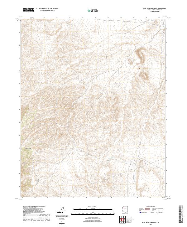
2021 Map of Rose Well Camp West
USGS Topo · Published 2021About this map
High desert terrain within t26n r7w and neighboring townships defines this portion of the Coconino plateau. The landscape is marked by the drainage of Chino Wash, which cuts across the southeastern quadrant of the survey. To the northwest, the land drops into the recesses of Crater Canyon, revealing a complex network of topographical contours that illustrate the drainage patterns and landforms of this uninhabited region. This 2021 update utilizes modern imagery and elevation data to document the unchanging physical geography of the area, providing a clear record of the natural landmarks that have guided travelers through this part of Arizona for generations.
Find a feature on this map
6 named features on this map. Tap any name to fly to it.
Don’t see what you’re looking for? This feature index may not catch every label — zoom into the map to look around manually.
Map Details
Editions of this 2021 Rose Well Camp West Map
This is the sole edition of this map. No revisions or reprints were ever made.
Other maps of this area

1886 · Diamond Creek
USGS Topo · 1:250,000

1886 · Chino
USGS Topo · 1:250,000

1891 · Chino
USGS Topo · 1:250,000

1892 · Diamond Creek
USGS Topo · 1:250,000

1948 · Williams
USGS Topo · 1:250,000

1954 · Williams
USGS Topo · 1:250,000

1956 · Williams
USGS Topo · 1:250,000

1960 · Williams
USGS Topo · 1:250,000

1961 · Williams
USGS Topo · 1:250,000
1967 · Frazier Wells
USGS Topo · 1:24,000