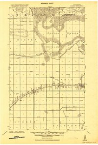
1918 Map of Roseau
USGS Topo · Published 1943About this map
The International Boundary between the United States and Canada defines the northern edge of this northern Minnesota landscape, where the vast Roseau Swamp and Roseau Lake dominate the geography. Surveyed during the First World War, the map reveals a remote territory being reshaped by drainage efforts, evidenced by numerous systems like Ditch 2. The Great Northern R. R. cuts a precise line across the township of Jadis, serving as the primary artery for local commerce and transport.
Find a feature on this map
21 named features on this map. Tap any name to fly to it.
Don’t see what you’re looking for? This feature index may not catch every label — zoom into the map to look around manually.
Map Details
Editions of this 1918 Roseau Map
2 editions found
Other maps of this area

1918 · Goos
USGS Topo · 1:62,500

1918 · Pencer
USGS Topo · 1:62,500

1918 · Roseau
USGS Topo · 1:62,500

1918 · Garland
USGS Topo · 1:62,500

1918 · Greenbush
USGS Topo · 1:62,500

1919 · Badger
USGS Topo · 1:62,500

1943 · Goos
USGS Topo · 1:62,500

1952 · Thief River Falls
USGS Topo · 1:250,000

1954 · Roseau
USGS Topo · 1:250,000

1956 · Thief River Falls
USGS Topo · 1:250,000