
1918 Map of Roseau
USGS Topo · Published 1918About this map
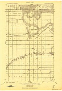
The International Boundary between the United States and Canada defines the northern edge of this northern Minnesota landscape. In this 1918 military survey, the region is dominated by the sprawling Roseau Swamp and the seasonal fluctuations of Roseau Lake, which acts as a wide catchment for the Roseau River and Pine Creek. The intricate network of drainage features like Lateral No. 6 and Ditch 2 indicates a concerted effort to reclaim the marshland for agricultural use during the early twentieth century.
Find a feature on this map
24 named features on this map. Tap any name to fly to it.
Don’t see what you’re looking for? This feature index may not catch every label — zoom into the map to look around manually.
Map Details
Editions of this 1918 Roseau Map
2 editions found
Other maps of this area

1918 · Goos
USGS Topo · 1:62,500

1918 · Pencer
USGS Topo · 1:62,500

1918 · Garland
USGS Topo · 1:62,500

1918 · Greenbush
USGS Topo · 1:62,500

1919 · Badger
USGS Topo · 1:62,500

1943 · Goos
USGS Topo · 1:62,500

1952 · Thief River Falls
USGS Topo · 1:250,000

1954 · Roseau
USGS Topo · 1:250,000

1956 · Thief River Falls
USGS Topo · 1:250,000

1957 · Roseau
USGS Topo · 1:250,000