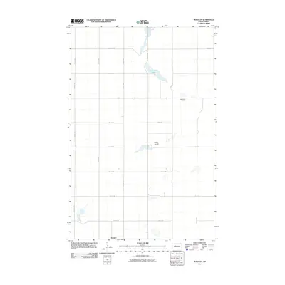
2011 Map of Roseglen
USGS Topo · Published 2011About this map
Roseglen sits at the southern edge of this McLean County landscape, serving as a focal point for a region defined by its precise section-line road network. The map reveals a rural geography where local travel is facilitated by a grid of routes such as 24th St NW and 55th Ave NW. This arrangement reflects the systematic land division of the Great Plains, where every mile of prairie was organized for agricultural settlement. North of the primary settlement, the topography is punctuated by Round Top Hill and the waters of Hiddenwood Lake. The presence of the Hiddenwood Cemetery along 29th St NW provides a significant touchstone for genealogists and local historians, marking the enduring legacy of the families who established farms across these expansive North Dakota townships.
Find a feature on this map
23 named features on this map. Tap any name to fly to it.
Don’t see what you’re looking for? This feature index may not catch every label — zoom into the map to look around manually.
Map Details
Editions of this 2011 Roseglen Map
This is the sole edition of this map. No revisions or reprints were ever made.
Other maps of this area

1954 · McClusky
USGS Topo · 1:250,000

1956 · Makoti SW
USGS Topo · 1:24,000

1956 · Blackwater Lake NW
USGS Topo · 1:24,000

1956 · Blackwater Lake
USGS Topo · 1:24,000

1956 · Blue Hill
USGS Topo · 1:24,000

1956 · Emmet
USGS Topo · 1:24,000

1956 · Roseglen
USGS Topo · 1:24,000

1958 · McClusky
USGS Topo · 1:250,000

1980 · Makoti
USGS Topo · 1:24,000
1980 · Wabek
USGS Topo · 1:24,000