
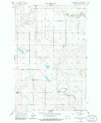
1956 Map of Blackwater Lake
USGS Topo · Published 1957About this map
Ft Berthold Indian Reservation Boundary divides this central North Dakota landscape, marking a transition across the prairie of McLean County. The map documents a rural school system in decline by the mid-1950s, noted by the prevalence of defunct institutions like School No 3, School No 4, and Ziegler Sch. In contrast, the White Shield Sch stands as an active center near the reservation line. Small local hubs are anchored by the Immanuel Ch and Roseglen Cem, while the hamlet of Glennon sits near the head of Coulee. The terrain is defined by low-lying wetlands and seasonal water bodies such as Brumwell Slough and Minehan Slough, which feed into Blackwater Lake and the West Branch of Douglas Creek.
Find a feature on this map
21 named features on this map. Tap any name to fly to it.
Don’t see what you’re looking for? This feature index may not catch every label — zoom into the map to look around manually.
Map Details
Editions of this 1956 Blackwater Lake Map
2 editions found
Other maps of this area

1954 · McClusky
USGS Topo · 1:250,000

1956 · Makoti SW
USGS Topo · 1:24,000

1956 · Blackwater Lake NW
USGS Topo · 1:24,000

1956 · Blue Hill
USGS Topo · 1:24,000

1956 · Emmet
USGS Topo · 1:24,000

1956 · Roseglen
USGS Topo · 1:24,000

1958 · McClusky
USGS Topo · 1:250,000

1967 · Blackwater Lake SE
USGS Topo · 1:24,000

1967 · Blackwater Lake SW
USGS Topo · 1:24,000

1967 · Emmet SW
USGS Topo · 1:24,000