Old Maps of White Shield, North Dakota
Explore 102 old maps of White Shield, spanning from 1953 to today. These high-resolution historic maps reveal how streets, neighborhoods, landmarks, and natural features evolved over time — perfect for genealogy, metal detecting, research, and local history exploration.
What you can do with these maps:
- See how White Shield changed over time: Compare historical maps to modern-day views to trace roads, homesites, rail lines & more.
- View detailed metadata: Each map includes creators, publishers, year, scale, and archive source.
- Overlay maps with satellite & LiDAR: Visualize the past alongside modern tools to explore terrain & human change.
- Trusted historical sources: Maps sourced from the USGS, Library of Congress, and other archives.
- Access maps your way: View online, download high-res files, or order prints for personal or research use.
Start exploring old maps of White Shield to uncover forgotten places, hidden landmarks, and the deep history beneath your feet.
White Shield, ND maps
(102)- 1953 Map of Watford City, 1968 Print
 1953 Watford City1968 Print · USGSNorth Dakota's badlands and the Missouri River basin are captured here during the 1950s and 60s as the Garrison Dam changed the landscape. Researchers can trace old rail lines like the Great Northern or find rural outposts such as Grassy Butte and Halliday.3 unique versions available
 - 1954 Map of McClusky, 1968 Print
 1954 McClusky1968 Print · USGSCentral North Dakota was undergoing a profound transformation in the fifties as the newly formed Lake Sakakawea reshaped the Missouri River valley. Genealogists and historians can trace rail-town development along the Soo Line and locate historic markers like Garrison Dam or the Lewis and Clark Trail.3 unique versions available
 - 1956 Map of Makoti SW
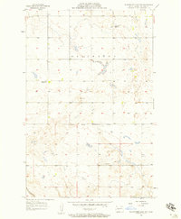
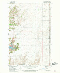
 1956 Makoti SW1956 Print · USGSThe McLean and Mountrail county border in the mid-1950s is captured here, showing a landscape of prairie potholes and rural outposts. Researchers can locate family landmarks like the Bethlehem Ch, Roseglen Cem, and the Wright Sch.
 - 1956 Map of Blackwater Lake NW, 1957 Print
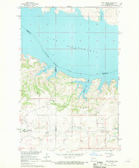
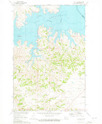
 1956 Blackwater Lake NW1957 Print · USGSNorth Dakota's high plains are documented here in the mid-fifties, capturing a landscape of remote farmsteads and tribal lands. Researchers can locate the Indian Scout Cem and trace the Ft Berthold Indian Reservation Boundary near School No 1.2 unique versions available
 - 1956 Map of Blackwater Lake, 1957 Print
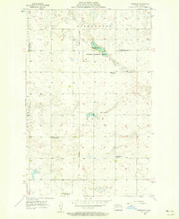
 1956 Blackwater Lake1957 Print · USGSMcLean County prairie land is captured here during the mid-fifties, showing the intersection of rural life and reservation boundaries. Researchers can trace the legacy of early education through several sites, including White Shield Sch and O'Shea Sch No 2.2 unique versions available
 - 1956 Map of Roseglen, 1958 Print
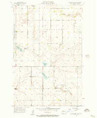
 1956 Roseglen1958 Print · USGSMcLean County in the mid-fifties presents a quiet landscape of prairie townships and conservation land. Genealogists and historians can trace the rural school system and the Old Indian Boundary near Roseglen and the Hiddenwood Cem.2 unique versions available
 - 1957 Map of Watford City
 1957 Watford City1957 Print · USGSWestern North Dakota's landscape is captured here during the mid-fifties as the Missouri River valley undergoes massive change following the creation of Garrison Reservoir. Genealogists and historians can trace dozens of rural schools like Divide School and early settlements such as Arnegard and Grassy Butte.
 - 1958 Map of McClusky
 1958 McClusky1958 Print · USGSCentral North Dakota was undergoing a profound change in the late fifties as the Garrison Reservoir filled behind its massive new dam. Trace the early layout of Riverdale, the Lewis and Clark Trail, and the vanishing rail stops of the Northern Pacific.
 - 1967 Map of Watford City
 1967 Watford City1967 Print · USGSWestern North Dakota is captured during a period of landscape transformation as the Missouri River valley was reshaped by the new Garrison Reservoir. Genealogists and local historians can trace the foundations of Watford City, find the Elkhorn Ranch Site, or locate rural landmarks like Ziner Butte and Grassy Butte.
 - 1967 Map of Blackwater Lake SE, 1969 Print
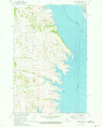
 1967 Blackwater Lake SE1969 Print · USGSThe Missouri River breaks into the sprawling Lake Sakakawea during the late sixties, reshaping the McLean County landscape. Genealogists and historians can trace local landmarks like St Andrews Ch, St Pauls Ch, and early coal interests at the Strip Mines.
 - 1967 Map of Raub SE, 1969 Print
 1967 Raub SE1969 Print · USGSThe Missouri River breaks into the sprawling Lake Sakakawea in the late sixties, defining this Mercer and McLean County landscape. Genealogists and historians can locate the Red Butte Cem and explore the Beaver Creek State Game Management Area.
 - 1967 Map of Raub NW, 1969 Print
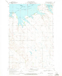
 1967 Raub NW1969 Print · USGSThe Missouri River Basin landscape comes into focus during the late sixties as the reservoir reshapes the McLean County shoreline. Genealogists and historians can trace the Fort Berthold Indian Reservation Boundary and locate the Memorial Ch near Arikara Bay.
 - 1967 Map of Raub, 1969 Print
 1967 Raub1969 Print · USGSMcLean County, North Dakota, is captured in the late sixties as the rising waters of Lake Sakakawea reshaped the northern landscape. Local historians can trace rural life through sites like Raub, Immaculate Conception Ch, and the Buffalo Rock Community Hall.
 - 1967 Map of Twin Buttes, 1969 Print
 1967 Twin Buttes1969 Print · USGSThe rising waters of Lake Sakakawea define this part of Mercer and Dunn County during the late 1960s. Researchers can locate numerous local landmarks including St Joseph Ch, Twin Buttes, and several rural cemeteries like Chase Cem.
 - 1967 Map of Blackwater Lake SW, 1969 Print
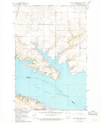 1967 Blackwater Lake SW1969 Print · USGSThe McLean County shoreline was significantly transformed by the mid-1960s as the rising Missouri River reshaped the landscape. Trace the geography of Nishu Bay and find local landmarks like Beaver Creek Cem and the Buffalo Rock Coulee.2 unique versions available
 - 1967 Map of Emmet SW, 1970 Print
 1967 Emmet SW1970 Print · USGSThe Missouri River valley undergoes a profound change in the late sixties as the Garrison Dam alters the landscape. Researchers can trace the submerged boundaries of the Old Fort Stevenson Military Reservation and locate the Lilly Dale Cem.
 - 1967 Map of Parshall SE, 1970 Print
 1967 Parshall SE1970 Print · USGSThe rural landscapes of McLean and Mountrail counties are captured here in the late 1960s as part of the Missouri River Basin development. Genealogists can trace local landmarks such as the Lucky Mound Ch and the Church of God Cem among the townships.
 - 1967 Map of Parshall SW, 1970 Print
 1967 Parshall SW1970 Print · USGSMcLean and Mountrail counties meet along the rising waters of the Missouri River Basin during the late sixties. Genealogists and researchers can trace the Fort Berthold Indian Reservation Boundary and find the local Townhall and Spring sites.2 unique versions available
 - 1969 Map of Beulah NE, 1971 Print
 1969 Beulah NE1971 Print · USGSThe Missouri River valley in Mercer County had recently transformed into a vast reservoir by the late sixties. Genealogists and local historians can trace legacy landmarks like Kronthal Cem, Koehler Cem, and the boundaries of the Fort Berthold Indian Reservation.2 unique versions available
 - 1970 Map of Hay Flat, 1973 Print
 1970 Hay Flat1973 Print · USGSDunn County's high plains meet the intricate new shoreline of the Missouri River Basin during the early seventies. Genealogists and local historians can locate Lincoln Memorial Cem and trace the rugged coulees surrounding Old Man Dancing Butte.
 - 1970 Map of Saddle Butte, 1973 Print
 1970 Saddle Butte1973 Print · USGSThe Missouri River breaks in western North Dakota are shown just as the reservoir reached its mature levels in the early seventies. Genealogists and researchers can trace the submerged county lines and find landmarks like Saddle Butte and Saddle Butte Bay.
 - 1982 Map of Parshall, 1983 Print
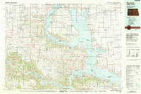 1982 Parshall1983 Print · USGSNorth Dakota's badlands and reservoir shorelines meet during the early eighties, showcasing a landscape shaped by both water and oil. Researchers can trace the development of New Town, locate the Riverview Cem, and explore the extent of the Antelope Oil Field.
 - 2011 Map of Blackwater Lake, 2011 Print
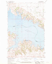
 2011 Blackwater Lake2011 Print · USGSCovers White Shield, including McLean County, United States, and other nearby areas
 - 2011 Map of Blackwater Lake NW, 2011 Print
 2011 Blackwater Lake NW2011 Print · USGSCovers White Shield, including McLean County, United States, and other nearby areas
 - 2011 Map of Makoti SW, 2011 Print
 2011 Makoti SW2011 Print · USGSCovers White Shield, including Parshall, Mountrail County, and other nearby areas
Showing maps 1-25 of 102
Top cities near White Shield
Top neighborhoods of White Shield
Frequently asked questions
- What are the different types of historical maps available for White Shield?
- What is the oldest map of White Shield?
- Where can I purchase historical maps of White Shield for my home or office?
- Where can I download high-res historical maps of White Shield?
- Are there historical topographic maps available for White Shield?
- Is there historical aerial imagery available for White Shield?
- Where are historical maps of White Shield sourced from?