1950s Maps of White Shield, North Dakota
Explore 8 historic maps of White Shield from the 1950s. These maps offer a rare glimpse into what life looked like during the 1950s — showing old roads, neighborhoods, homes, and landmarks that have changed or disappeared over time.
Whether you're researching your family's past, planning a metal detecting trip, or studying how White Shield's landscape evolved across the 1950s, these high-resolution maps are a powerful tool for exploring the history of this region.
- Focus on a specific era: All maps on this page are from the 1950s, giving you a focused view of this time period.
- See what’s changed: Compare century-old streets, trails, and buildings to today's modern landscape using overlays and satellite layers.
- Research with precision: Use these maps for genealogy, historical research, land use analysis, or educational projects.
- View, download, or print: Maps are fully viewable online in high resolution, and can be downloaded or printed for your own records.
Start exploring White Shield's history through authentic maps from the 1950s. This is your window into the past.
White Shield, ND maps
(8)- 1953 Map of Watford City, 1968 Print
 1953 Watford City1968 Print · USGSNorth Dakota's badlands and the Missouri River basin are captured here during the 1950s and 60s as the Garrison Dam changed the landscape. Researchers can trace old rail lines like the Great Northern or find rural outposts such as Grassy Butte and Halliday.3 unique versions available
 - 1954 Map of McClusky, 1968 Print
 1954 McClusky1968 Print · USGSCentral North Dakota was undergoing a profound transformation in the fifties as the newly formed Lake Sakakawea reshaped the Missouri River valley. Genealogists and historians can trace rail-town development along the Soo Line and locate historic markers like Garrison Dam or the Lewis and Clark Trail.3 unique versions available
 - 1956 Map of Makoti SW
 1956 Makoti SW1956 Print · USGSThe McLean and Mountrail county border in the mid-1950s is captured here, showing a landscape of prairie potholes and rural outposts. Researchers can locate family landmarks like the Bethlehem Ch, Roseglen Cem, and the Wright Sch.
 - 1956 Map of Blackwater Lake NW, 1957 Print
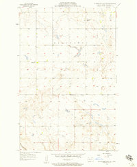 1956 Blackwater Lake NW1957 Print · USGSNorth Dakota's high plains are documented here in the mid-fifties, capturing a landscape of remote farmsteads and tribal lands. Researchers can locate the Indian Scout Cem and trace the Ft Berthold Indian Reservation Boundary near School No 1.2 unique versions available
 - 1956 Map of Blackwater Lake, 1957 Print
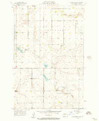 1956 Blackwater Lake1957 Print · USGSMcLean County prairie land is captured here during the mid-fifties, showing the intersection of rural life and reservation boundaries. Researchers can trace the legacy of early education through several sites, including White Shield Sch and O'Shea Sch No 2.2 unique versions available
 - 1956 Map of Roseglen, 1958 Print
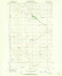 1956 Roseglen1958 Print · USGSMcLean County in the mid-fifties presents a quiet landscape of prairie townships and conservation land. Genealogists and historians can trace the rural school system and the Old Indian Boundary near Roseglen and the Hiddenwood Cem.2 unique versions available
 - 1957 Map of Watford City
 1957 Watford City1957 Print · USGSWestern North Dakota's landscape is captured here during the mid-fifties as the Missouri River valley undergoes massive change following the creation of Garrison Reservoir. Genealogists and historians can trace dozens of rural schools like Divide School and early settlements such as Arnegard and Grassy Butte.
 - 1958 Map of McClusky
 1958 McClusky1958 Print · USGSCentral North Dakota was undergoing a profound change in the late fifties as the Garrison Reservoir filled behind its massive new dam. Trace the early layout of Riverdale, the Lewis and Clark Trail, and the vanishing rail stops of the Northern Pacific.
End of results
Showing maps 1-8 of 8
Top cities near White Shield
Top neighborhoods of White Shield
Frequently asked questions
- What are the different types of historical maps available for White Shield?
- What is the oldest map of White Shield?
- Where can I purchase historical maps of White Shield for my home or office?
- Where can I download high-res historical maps of White Shield?
- Are there historical topographic maps available for White Shield?
- Is there historical aerial imagery available for White Shield?
- Where are historical maps of White Shield sourced from?