1960s Maps of White Shield, North Dakota
Explore 11 historic maps of White Shield from the 1960s. These maps offer a rare glimpse into what life looked like during the 1960s — showing old roads, neighborhoods, homes, and landmarks that have changed or disappeared over time.
Whether you're researching your family's past, planning a metal detecting trip, or studying how White Shield's landscape evolved across the 1960s, these high-resolution maps are a powerful tool for exploring the history of this region.
- Focus on a specific era: All maps on this page are from the 1960s, giving you a focused view of this time period.
- See what’s changed: Compare century-old streets, trails, and buildings to today's modern landscape using overlays and satellite layers.
- Research with precision: Use these maps for genealogy, historical research, land use analysis, or educational projects.
- View, download, or print: Maps are fully viewable online in high resolution, and can be downloaded or printed for your own records.
Start exploring White Shield's history through authentic maps from the 1960s. This is your window into the past.
White Shield, ND maps
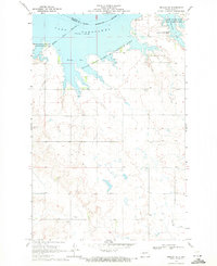
(11)- 1967 Map of Watford City
 1967 Watford City1967 Print · USGSWestern North Dakota is captured during a period of landscape transformation as the Missouri River valley was reshaped by the new Garrison Reservoir. Genealogists and local historians can trace the foundations of Watford City, find the Elkhorn Ranch Site, or locate rural landmarks like Ziner Butte and Grassy Butte.
 - 1967 Map of Blackwater Lake SE, 1969 Print
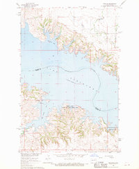
 1967 Blackwater Lake SE1969 Print · USGSThe Missouri River breaks into the sprawling Lake Sakakawea during the late sixties, reshaping the McLean County landscape. Genealogists and historians can trace local landmarks like St Andrews Ch, St Pauls Ch, and early coal interests at the Strip Mines.
 - 1967 Map of Raub SE, 1969 Print
 1967 Raub SE1969 Print · USGSThe Missouri River breaks into the sprawling Lake Sakakawea in the late sixties, defining this Mercer and McLean County landscape. Genealogists and historians can locate the Red Butte Cem and explore the Beaver Creek State Game Management Area.
 - 1967 Map of Raub NW, 1969 Print
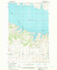
 1967 Raub NW1969 Print · USGSThe Missouri River Basin landscape comes into focus during the late sixties as the reservoir reshapes the McLean County shoreline. Genealogists and historians can trace the Fort Berthold Indian Reservation Boundary and locate the Memorial Ch near Arikara Bay.
 - 1967 Map of Raub, 1969 Print
 1967 Raub1969 Print · USGSMcLean County, North Dakota, is captured in the late sixties as the rising waters of Lake Sakakawea reshaped the northern landscape. Local historians can trace rural life through sites like Raub, Immaculate Conception Ch, and the Buffalo Rock Community Hall.
 - 1967 Map of Twin Buttes, 1969 Print
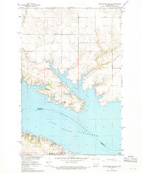
 1967 Twin Buttes1969 Print · USGSThe rising waters of Lake Sakakawea define this part of Mercer and Dunn County during the late 1960s. Researchers can locate numerous local landmarks including St Joseph Ch, Twin Buttes, and several rural cemeteries like Chase Cem.
 - 1967 Map of Blackwater Lake SW, 1969 Print
 1967 Blackwater Lake SW1969 Print · USGSThe McLean County shoreline was significantly transformed by the mid-1960s as the rising Missouri River reshaped the landscape. Trace the geography of Nishu Bay and find local landmarks like Beaver Creek Cem and the Buffalo Rock Coulee.2 unique versions available
 - 1967 Map of Emmet SW, 1970 Print
 1967 Emmet SW1970 Print · USGSThe Missouri River valley undergoes a profound change in the late sixties as the Garrison Dam alters the landscape. Researchers can trace the submerged boundaries of the Old Fort Stevenson Military Reservation and locate the Lilly Dale Cem.
 - 1967 Map of Parshall SE, 1970 Print
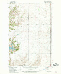
 1967 Parshall SE1970 Print · USGSThe rural landscapes of McLean and Mountrail counties are captured here in the late 1960s as part of the Missouri River Basin development. Genealogists can trace local landmarks such as the Lucky Mound Ch and the Church of God Cem among the townships.
 - 1967 Map of Parshall SW, 1970 Print
 1967 Parshall SW1970 Print · USGSMcLean and Mountrail counties meet along the rising waters of the Missouri River Basin during the late sixties. Genealogists and researchers can trace the Fort Berthold Indian Reservation Boundary and find the local Townhall and Spring sites.2 unique versions available
 - 1969 Map of Beulah NE, 1971 Print
 1969 Beulah NE1971 Print · USGSThe Missouri River valley in Mercer County had recently transformed into a vast reservoir by the late sixties. Genealogists and local historians can trace legacy landmarks like Kronthal Cem, Koehler Cem, and the boundaries of the Fort Berthold Indian Reservation.2 unique versions available
End of results
Showing maps 1-11 of 11
Top cities near White Shield
Top neighborhoods of White Shield
Frequently asked questions
- What are the different types of historical maps available for White Shield?
- What is the oldest map of White Shield?
- Where can I purchase historical maps of White Shield for my home or office?
- Where can I download high-res historical maps of White Shield?
- Are there historical topographic maps available for White Shield?
- Is there historical aerial imagery available for White Shield?
- Where are historical maps of White Shield sourced from?