
1967 Map of Raub NW
USGS Topo · Published 1969About this map
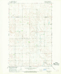
Lake Sakakawea dominates the western landscape of this North Dakota quadrangle, its intricate shoreline carving deep into the Missouri River Basin. The map details a period when conservation and recreation were primary uses for these lands, evidenced by the expansive State Game Management Area surrounding Deepwater Creek Bay. Along the eastern edge, the Fort Berthold Indian Reservation Boundary runs through the prairie, marking a significant transition in land management and history. Inland, the isolated Memorial Ch stands as a focal point for the local community, while smaller drainages like Charging Creek and Arikara Bay feed into the massive reservoir. Public access points, including the Deepwater Creek Public Use Area and its Boat Ramp, highlight the post-dam development of the region for outdoorsmen and residents alike.
Find a feature on this map
10 named features on this map. Tap any name to fly to it.
Don’t see what you’re looking for? This feature index may not catch every label — zoom into the map to look around manually.
Map Details
Editions of this 1967 Raub NW Map
This is the sole edition of this map. No revisions or reprints were ever made.
Other maps of this area

1953 · Watford City
USGS Topo · 1:250,000

1957 · Watford City
USGS Topo · 1:250,000

1967 · Watford City
USGS Topo · 1:250,000

1967 · Raub SE
USGS Topo · 1:24,000

1967 · Raub
USGS Topo · 1:24,000

1967 · Twin Buttes
USGS Topo · 1:24,000
1967 · Parshall SE
USGS Topo · 1:24,000

1967 · Parshall SW
USGS Topo · 1:24,000

1967 · New Town SE
USGS Topo · 1:24,000

1970 · Hay Flat
USGS Topo · 1:24,000