
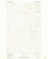
1967 Map of Twin Buttes
USGS Topo · Published 1969About this map
Lake Sakakawea dominates the northern landscape of this survey, representing a critical era of the Missouri River Basin development project. The reservoir’s irregular shoreline is defined by deep inlets like Mandan Bay and Elbowoods Bay, marking the point where the rising waters reshaped the traditional river valley. Along the southern banks, the settlement of Twin Buttes and the Twin Buttes Public Use Area serve as focal points for local activity. The interior topography is a network of ridges and drainages like Malnourie Creek, punctuated by several family and community landmarks. Genealogists will find significant value in the distribution of local burial sites, including Crowsheart Cem, St Joseph Cem, Medicine Stone Cem, Holen Cem, and Chase Cem, often located near small rural centers like the St Joseph Ch. This map records a landscape transitioning from traditional prairie use to a managed water resource system.
Find a feature on this map
23 named features on this map. Tap any name to fly to it.
Don’t see what you’re looking for? This feature index may not catch every label — zoom into the map to look around manually.
Map Details
Editions of this 1967 Twin Buttes Map
This is the sole edition of this map. No revisions or reprints were ever made.
Other maps of this area

1953 · Watford City
USGS Topo · 1:250,000

1957 · Watford City
USGS Topo · 1:250,000

1967 · Watford City
USGS Topo · 1:250,000

1967 · Raub SE
USGS Topo · 1:24,000

1967 · Raub NW
USGS Topo · 1:24,000

1967 · Raub
USGS Topo · 1:24,000

1970 · Halliday NE
USGS Topo · 1:24,000

1970 · Hay Flat
USGS Topo · 1:24,000
1970 · Golden Valley NE
USGS Topo · 1:24,000

1970 · Golden Valley NW
USGS Topo · 1:24,000