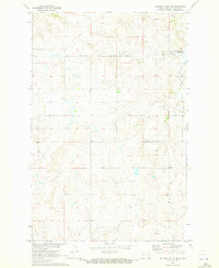
1970 Map of Golden Valley NE
USGS Topo · Published 1973About this map
Fort Berthold Indian Reservation Boundary cuts through the northern section of this landscape, marking a significant jurisdictional and cultural line in Mercer County. The shoreline of Lake Sakakawea Elev 1838 dominates the northeastern corner, where the rising reservoir waters met the winding course of Beaver Creek. This 1970 field check captures the area after the completion of the Garrison Dam, showing a landscape defined by water management and rural subsistence.
Find a feature on this map
7 named features on this map. Tap any name to fly to it.
Don’t see what you’re looking for? This feature index may not catch every label — zoom into the map to look around manually.
Map Details
Editions of this 1970 Golden Valley NE Map
2 editions found
Other maps of this area

1953 · Watford City
USGS Topo · 1:250,000

1954 · McClusky
USGS Topo · 1:250,000

1957 · Watford City
USGS Topo · 1:250,000

1958 · McClusky
USGS Topo · 1:250,000

1967 · Watford City
USGS Topo · 1:250,000

1967 · Raub SE
USGS Topo · 1:24,000

1967 · Twin Buttes
USGS Topo · 1:24,000

1967 · Blackwater Lake SW
USGS Topo · 1:24,000
1969 · Beulah NW
USGS Topo · 1:24,000

1969 · Zap
USGS Topo · 1:24,000