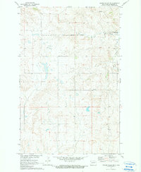
1970 Map of Golden Valley NE
USGS Topo · Published 1990About this map
The Fort Berthold Indian Reservation Boundary cuts across the northern landscape of this Mercer County region, marking a significant intersection of jurisdictional and cultural history. The topography is defined by the expansive waters of Lake Sakakawea Elev 1838, where the reservoir has reshaped the drainage of Beaver Creek. This 1970 survey captures the area as it was managed for the development of the Missouri River Basin, showing a landscape of scattered resource extraction and rural landmarks. Local history is anchored by the Nayzatch Cem, while small-scale industrial activity is evidenced by a Gravel Pit and various isolated Wells dotting the terrain. The map provides a clear look at the surveyed sections and township lines that define this portion of North Dakota's prairie country during a period of significant water management and land use changes.
Find a feature on this map
6 named features on this map. Tap any name to fly to it.
Don’t see what you’re looking for? This feature index may not catch every label — zoom into the map to look around manually.
Map Details
Editions of this 1970 Golden Valley NE Map
2 editions found
Other maps of this area

1953 · Watford City
USGS Topo · 1:250,000

1954 · McClusky
USGS Topo · 1:250,000

1957 · Watford City
USGS Topo · 1:250,000

1958 · McClusky
USGS Topo · 1:250,000

1967 · Watford City
USGS Topo · 1:250,000

1967 · Raub SE
USGS Topo · 1:24,000

1967 · Twin Buttes
USGS Topo · 1:24,000

1967 · Blackwater Lake SW
USGS Topo · 1:24,000
1969 · Beulah NW
USGS Topo · 1:24,000

1969 · Zap
USGS Topo · 1:24,000