
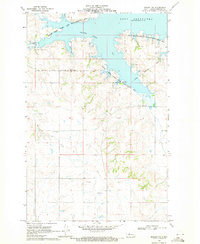
1969 Map of Zap
USGS Topo · Published 1971About this map
Spring Creek meanders eastward through the valley floor, anchoring the small community of Zap during the late 1960s. This survey, facilitated by the State of North Dakota Water Commission, details a landscape where industrial activity and rural life intersect. Evidence of local extraction is visible at the Gravel Pit and a prominent Strip Mine in the southeastern corner, reflecting the region's mineral economy.
Find a feature on this map
12 named features on this map. Tap any name to fly to it.
Don’t see what you’re looking for? This feature index may not catch every label — zoom into the map to look around manually.
Map Details
Editions of this 1969 Zap Map
This is the sole edition of this map. No revisions or reprints were ever made.
Other maps of this area

1953 · Watford City
USGS Topo · 1:250,000

1954 · McClusky
USGS Topo · 1:250,000

1957 · Watford City
USGS Topo · 1:250,000

1958 · McClusky
USGS Topo · 1:250,000

1967 · Watford City
USGS Topo · 1:250,000

1968 · Beulah
USGS Topo · 1:24,000

1968 · Medicine Butte NE
USGS Topo · 1:24,000

1968 · Medicine Butte
USGS Topo · 1:24,000

1969 · Beulah NE
USGS Topo · 1:24,000
1969 · Beulah NW
USGS Topo · 1:24,000