
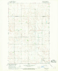
1956 Map of Makoti SW
USGS Topo · Published 1956About this map
Amundsville and Deepwater townships define the landscape of this 1956 survey, which documents the prairie terrain of central North Dakota along the border of Mountrail and McLean counties. The map focuses heavily on the conservation and social landmarks of the era, most notably the Lake Susie National Wildlife Refuge centered on Lake Susie. The area's rural social infrastructure is well-preserved, showing the placement of the Wright Sch, Bethlehem Ch, and Roseglen Cem. The drainage patterns of Deepwater Creek and numerous small potholes and depressions reflect the glaciated topography characteristic of the region. This detailed record is essential for genealogists tracing families in the Mountrail and Amundsville areas before the consolidation of many rural school districts and parishes.
Find a feature on this map
11 named features on this map. Tap any name to fly to it.
Don’t see what you’re looking for? This feature index may not catch every label — zoom into the map to look around manually.
Map Details
Editions of this 1956 Makoti SW Map
This is the sole edition of this map. No revisions or reprints were ever made.
Other maps of this area

1953 · Watford City
USGS Topo · 1:250,000

1954 · McClusky
USGS Topo · 1:250,000

1956 · Blackwater Lake NW
USGS Topo · 1:24,000

1956 · Blackwater Lake
USGS Topo · 1:24,000

1956 · Roseglen
USGS Topo · 1:24,000

1957 · Watford City
USGS Topo · 1:250,000

1958 · McClusky
USGS Topo · 1:250,000

1967 · Watford City
USGS Topo · 1:250,000

1967 · Raub
USGS Topo · 1:24,000
1967 · Parshall SE
USGS Topo · 1:24,000