
1967 Map of Blackwater Lake SE
USGS Topo · Published 1969About this map
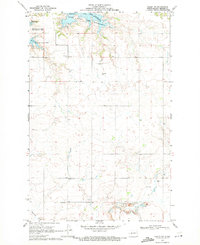
Lake Sakakawea dominates the southern half of this landscape, its expansive waters formed by the impoundment of the Missouri River. The shoreline is deeply indented with points and inlets, notably around Beulah Bay, where a Boat Ramp and Public Use Area suggest the mid-century development of the region for recreation. Further north, the upland terrain of Blackwater is marked by the presence of several Strip Mines, indicating the industrial extraction of lignite coal alongside the traditional prairie landscape.
Find a feature on this map
18 named features on this map. Tap any name to fly to it.
Don’t see what you’re looking for? This feature index may not catch every label — zoom into the map to look around manually.
Map Details
Editions of this 1967 Blackwater Lake SE Map
This is the sole edition of this map. No revisions or reprints were ever made.
Other maps of this area

1954 · McClusky
USGS Topo · 1:250,000

1956 · Blackwater Lake NW
USGS Topo · 1:24,000

1956 · Blackwater Lake
USGS Topo · 1:24,000

1956 · Emmet
USGS Topo · 1:24,000

1958 · McClusky
USGS Topo · 1:250,000

1967 · Blackwater Lake SW
USGS Topo · 1:24,000

1967 · Emmet SW
USGS Topo · 1:24,000

1969 · Beulah NE
USGS Topo · 1:24,000
1969 · Hazen NW
USGS Topo · 1:24,000
1969 · Beulah NW
USGS Topo · 1:24,000