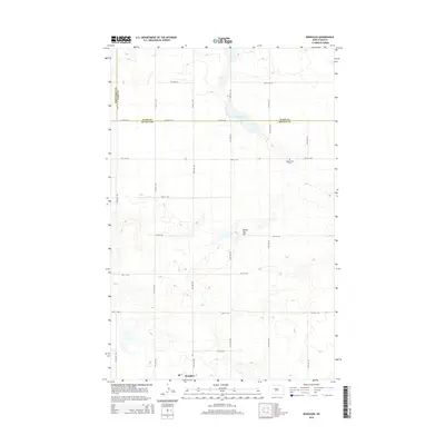
2014 Map of Roseglen
USGS Topo · Published 2014About this map
Roseglen sits at the southern edge of this West-Central North Dakota landscape, situated within a vast grid of section roads that define the rural agricultural character of the region. The map captures the intersection of three counties—Mountrail, Ward, and McLean—illustrating how administrative boundaries cut across the rolling prairie. Natural features are sparse but significant, notably the elongated Hiddenwood Lake and the prominent elevation of Round Top Hill. For those tracing local heritage, the Hiddenwood Cem serves as a key landmark in this sparsely populated township. The drainage patterns and topographic contours reveal a glaciated terrain where small seasonal basins dot the landscape between established routes like 30th St NW and 60th Ave NW.
Find a feature on this map
25 named features on this map. Tap any name to fly to it.
Don’t see what you’re looking for? This feature index may not catch every label — zoom into the map to look around manually.
Map Details
Editions of this 2014 Roseglen Map
This is the sole edition of this map. No revisions or reprints were ever made.
Other maps of this area

1954 · McClusky
USGS Topo · 1:250,000

1956 · Makoti SW
USGS Topo · 1:24,000

1956 · Blackwater Lake NW
USGS Topo · 1:24,000

1956 · Blackwater Lake
USGS Topo · 1:24,000

1956 · Blue Hill
USGS Topo · 1:24,000

1956 · Emmet
USGS Topo · 1:24,000

1956 · Roseglen
USGS Topo · 1:24,000

1958 · McClusky
USGS Topo · 1:250,000

1980 · Makoti
USGS Topo · 1:24,000
1980 · Wabek
USGS Topo · 1:24,000