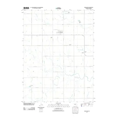
2011 Map of Roseland
USGS Topo · Published 2011About this map
Roseland serves as the primary hub for this agricultural portion of Adams County, where the Roseland Post Office remains a central point of the community. The landscape is defined by the historic paths of western expansion, reflected in modern road names that follow the legacy of pioneer travel. Drainage patterns are dominated by the Little Blue River and several tributaries including Scott Creek, Cottonwood Creek, and Flat Creek. Local water management is evident through numerous private water features such as Trausch Reservoir, Larsen Reservoir, and Shaw Reservoir, each with its associated dam. For those researching local family histories, the area is anchored by three significant burial sites: Roseland Cemetery, Silver Lake Cemetery, and the Mennonite Cemetery, which provide a geographic record of the diverse settler populations who established this prairie region.
Find a feature on this map
35 named features on this map. Tap any name to fly to it.
Don’t see what you’re looking for? This feature index may not catch every label — zoom into the map to look around manually.
Map Details
Editions of this 2011 Roseland Map
This is the sole edition of this map. No revisions or reprints were ever made.
Other maps of this area

1894 · Kenesaw
USGS Topo · 1:62,500

1896 · Wood River
USGS Topo · 1:125,000

1897 · Red Cloud
USGS Topo · 1:125,000

1898 · Superior
USGS Topo · 1:125,000

1898 · Grand Island
USGS Topo · 1:125,000

1955 · Grand Island
USGS Topo · 1:250,000

1957 · Grand Island
USGS Topo · 1:250,000

1958 · Grand Island
USGS Topo · 1:250,000

1969 · Blue Hill
USGS Topo · 1:24,000
1969 · Holstein
USGS Topo · 1:24,000