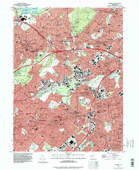
1995 Map of Roselle
USGS Topo · Published 1998About this map
The Rahway Valley RR and Morris and Essex RR define the suburban landscape of Union and Essex counties during this mid-1990s update of 1940s topography. The map illustrates a dense network of residential communities, including Westfield, Summit, and Cranford, interspersed with significant public and private landmarks. The Rahway River and its branches, such as Nomahegan Brook, wind through established greenspaces like Lenape Park and the South Branch Rahway River.
Find a feature on this map
68 named features on this map. Tap any name to fly to it.
Don’t see what you’re looking for? This feature index may not catch every label — zoom into the map to look around manually.
Map Details
Editions of this 1995 Roselle Map
This is the sole edition of this map. No revisions or reprints were ever made.
Other maps of this area

1888 · Plainfield
USGS Topo · 1:62,500

1888 · Morristown
USGS Topo · 1:62,500

1888 · Paterson
USGS Topo · 1:62,500

1892 · Paterson
USGS Topo · 1:62,500

1893 · Plainfield
USGS Topo · 1:62,500

1894 · Morristown
USGS Topo · 1:62,500

1898 · Morristown
USGS Topo · 1:62,500

1898 · Plainfield
USGS Topo · 1:62,500

1898 · Staten Island
USGS Topo · 1:62,500

1898 · Paterson
USGS Topo · 1:62,500